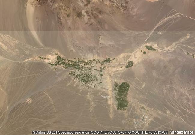
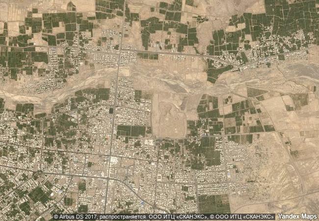
Bam and its Cultural Landscape
Kerman Province, Bam District
|

|
Identifier |
1208 |
|

|
states |
ir |
|

|
category |
cultural |
|

|
criteria |
(ii)(iii)(iv)(v) |
|

|
Title |
bam and its cultural landscape |
|

|
latitude |
29.1168308258 |
|

|
longitude |
58.3666687012 |
|

|
location |
kerman province, bam district |
|

|
Region |
asia and the pacific |
|

|
year |
2004 |
|

|
unique number |
1564 |
|

|
description |
bam is situated in a desert environment on the southern edge of the iranian high plateau. the origins of bam can be traced back to the achaemenid period (6th to 4th centuries bc). its heyday was from the 7th to 11th centuries, being at the crossroads of important trade routes and known for the production of silk and cotton garments. the existence of life in the oasis was based on the underground irrigation canals, the qanāts, of which bam has preserved some of the earliest evidence in iran. arg-e bam is the most representative example of a fortified medieval town built in vernacular technique using mud layers (chineh ). |
|

|
justification |
criterion (ii): bam developed at the crossroads of important trade routes at the southern side of the iranian high plateau, and it became an outstanding example of the interaction of the various influences.
criterion (iii): the bam and its cultural landscape represents an exceptional testimony to the development of a trading settlement in the desert environment of the central asian region.
criterion (iv): the city of bam represents an outstanding example of a fortified settlement and citadel in the central asian region, based on the use mud layer technique (chineh) combined with mud bricks (khesht).
criterion (v): the cultural landscape of bam is an outstanding representation of the interaction of man and nature in a desert environment, using the qanats. the system is based on a strict social system with precise tasks and responsibilities, which have been maintained in use until the present, but has now become vulnerable to irreversible change. |
|


 0
0


 1 X ™ unesco
 Info
Info
 Map
Map
 similar
 language