X xXx 1
unesco


Crac des Chevaliers and Qal’at Salah El-Din

Municipalities of Al Hosn and Haffeh

9.637.90 km
0

Crac des Chevaliers and Qal’at Salah El-Din


Municipalities of Al Hosn and Haffeh
Identifier 1229
states sy
category cultural
criteria (ii)(iv)
Title crac des chevaliers and qal’at salah el-din
latitude 34.7566680908
longitude 36.2944450378
location municipalities of al hosn and haffeh
Region arab states
year 2006
unique number 1406
description 
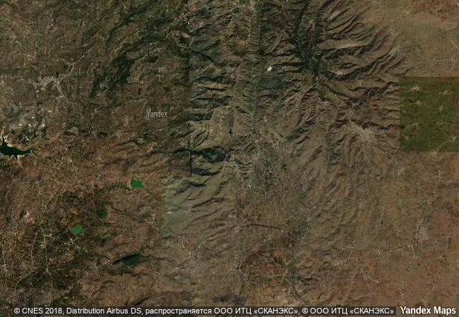
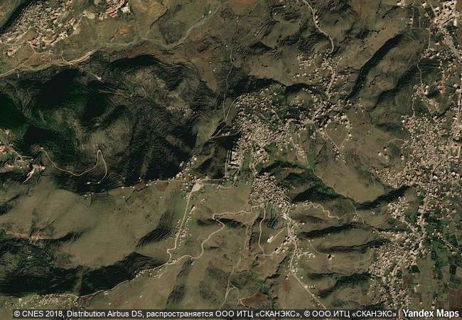
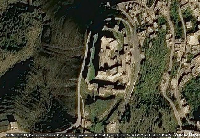
these two castles represent the most significant examples illustrating the exchange of influences and documenting the evolution of fortified architecture in the near east during the time of the crusades (11th - 13th centuries). the crac des chevaliers was built by the hospitaller order of saint john of jerusalem from 1142 to 1271. with further construction by the mamluks in the late 13th century, it ranks among the best-preserved examples of the crusader castles. the qal’at salah el-din (fortress of saladin), even though partly in ruins, represents an outstanding example of this type of fortification, both in terms of the quality of construction and the survival of historical stratigraphy. it retains features from its byzantine beginnings in the 10th century, the frankish transformations in the late 12th century and fortifications added by the ayyubid dynasty (late 12th to mid-13th century).
6.2 M

Syria
www.X-X-X.NAME
34.7566680908 ° × 36.2944450378 °

34 ° 45 ′ 24 ″ N × 36 ° 18 ′ 40 ″ E
9.637.90 km

5 ° N>NE
Syria, Homs Governorate

Syria / Homs Governorate
Erbil Citadel

Arab States

9.963.85 km
Site of Palmyra

Province of Homs

9.774.29 km
Imperial Palaces of the Ming and Qing Dynasties in Beijing and Shenyang

Asia and the Pacific

10.540.45 km
The work of engineer Eladio Dieste: Church of Atlántida

Latin America and the Caribbean

8.764.20 km
Historic City of Meknes

region centre sud, Wilaya de Meknes

6.698.41 km
Protective town of San Miguel and the Sanctuary of Jesús Nazareno de Atotonilco

Guanajuato Region

2.705.19 km
Historic Centres of Stralsund and Wismar

State of Mecklenburg-Western Pomerania (Mecklenburg-Vorpommern)

6.860.29 km
Tchogha Zanbil

Khuzestan

10.584.65 km
Ban Chiang Archaeological Site

Udon Thani Province

13.603.03 km
The Ancient Town of Si Thep and its Associated Dvaravati Monuments

Asia and the Pacific

13.836.71 km
Rohtas Fort

Jhelum City, Punjab

11.556.31 km
Garden Kingdom of Dessau-Wörlitz

State of Saxony-Anhalt (Sachsen-Anhalt)

6.960.41 km

©

1 X ™


BRAND COM CORP GLOBAL INT

AAA BASE GRAND HIGH ORIGINAL QUALITY TOP UNIQUE

X-X-X•NAME
1 X ™ unesco
Info
Map
similar
language
guest


1 X
-4
IP : America/New_York
-4
IP : America/New_York