xXx X 1
unesco


Ancient City of Tauric Chersonese and its Chora

Europe and North America

8.675.05 km
0

Ancient City of Tauric Chersonese and its Chora


Identifier 1411
states ua
category cultural
criteria (ii)(v)
Title ancient city of tauric chersonese and its chora
latitude 44.6108322144
longitude 33.4913902283
Region europe and north america
year 2013
unique number 1895
description 
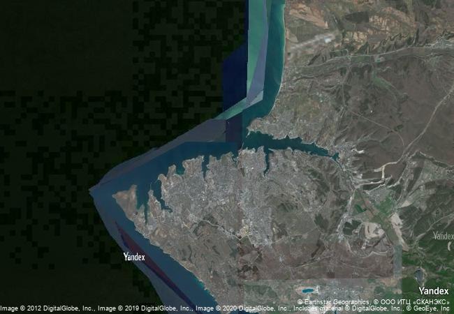
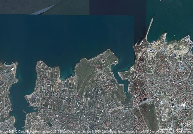
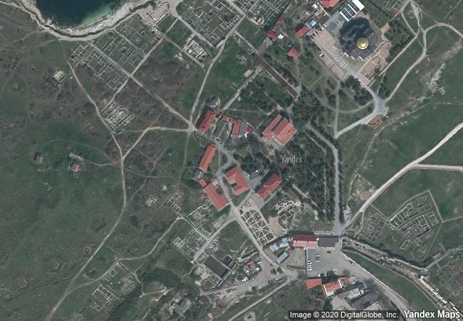
the site features the remains of a city founded by dorian greeks in the 5th century bc on the northern shores of the black sea. it encompasses six component sites with urban remains and agricultural lands divided into several hundreds of chora, rectangular plots of equal size. the plots supported vineyards whose production was exported by the city which thrived until the 15th century. the site features several public building complexes and residential neighbourhoods, as well as early christian monuments alongside remains from stone and bronze age settlements; roman and medieval tower fortifications and water supply systems; and exceptionally well-preserved examples of vineyard planting and dividing walls. in the 3rd century ad, the site was known as the most productive wine centre of the black sea and remained a hub of exchange between the greek, roman and byzantine empires and populations north of the black sea. it is an outstanding example of democratic land organization linked to an ancient polis, reflecting the city’s social organization.
9.6 M
(3)

Russian Federation
386.3 K
(1)

Sevastopol
www.X-X-X.NAME
44,61 ° × 33,49 °

44 ° 37 ′ 39 ″ N × 33 ° 29 ′ 29 ″ E
8.675.05 km

317 ° N>NW
Russia, Sevastopol, Gagarinskiy City Administrative District

Russia / Southern Federal District / Crimean Peninsula / Sevastopol / Gagarinskiy City Administrative District
The Archaeological Heritage of Niah National Park’s Caves Complex

Asia and the Pacific

14.854.17 km
Pontcysyllte Aqueduct and Canal

Wrexham County Borough, County of Denbighshire, Borough of Oswestry, County of Shropshire

5.958.98 km
Historic Monuments of Dengfeng in “The Centre of Heaven and Earth”

Asia and the Pacific

11.576.97 km
Aqueduct of Padre Tembleque Hydraulic System

Latin America and the Caribbean

2.689.98 km
Major Mining Sites of Wallonia

Europe and North America

6.508.50 km
Precolumbian Chiefdom Settlements with Stone Spheres of the Diquís

Latin America and the Caribbean

3.450.06 km
Cahokia Mounds State Historic Site

Collinsville, Illinois

623.88 km
Twyfelfontein or /Ui-//aes

Kunene Region

12.069.85 km
San Antonio Missions

Europe and North America

1.838.18 km
Soltaniyeh

Zanjan province

10.195.97 km
Centennial Hall in Wrocław

Silesia Region, Lower Silesian Voivodship

7.276.56 km
Buddhist Monuments in the Horyu-ji Area

Nara Prefecture

10.819.72 km

©

1 X ™


BRAND COM CORP GLOBAL INT

AAA BASE GRAND HIGH ORIGINAL QUALITY TOP UNIQUE

X-X-X•NAME
1 X ™ unesco
Info
Map
similar
language
guest


1 X
-4
IP : America/New_York
-4
IP : America/New_York