X 1 xXx ™
2
3
⬤
unesco
⬤


☆
Antigua Naval Dockyard and Related Archaeological Sites

Latin America and the Caribbean

3.271.17 km
☆
★★★★☆
0

Antigua Naval Dockyard and Related Archaeological Sites


Identifier 1499
states ag
category cultural
criteria (ii)(iv)
Title antigua naval dockyard and related archaeological sites
latitude 17.0069446564
longitude -61.7616653442
Region latin america and the caribbean
year 2016
unique number 2086
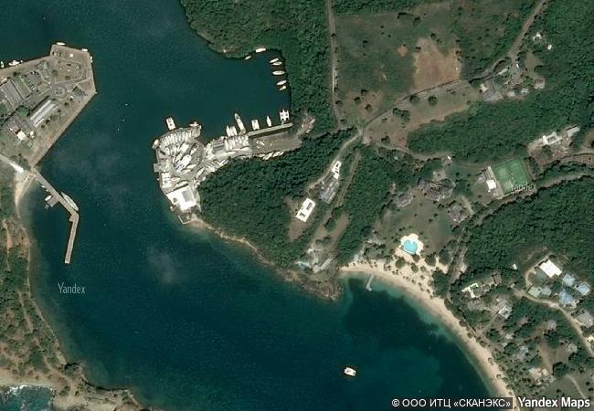
description the site consists of a group of georgian-style naval buildings and structures, set within a walled enclosure. the natural environment of this side of the island of antigua, with its deep, narrow bays surrounded by highlands, offered shelter from hurricanes and was ideal for repairing ships. the construction of the dockyard by the british navy would not have been possible without the labour of generations of enslaved africans since the end of the 18th century. its aim was to protect the interests of sugar cane planters at a time when european powers were competing for control of the eastern caribbean.
☆
6.27 M

Antigua and Barbuda
www.X-X-X.NAME
17,00 ° × -61,76 °

17 ° 00 ′ 25 ″ N × 61 ° 46 ′ 42 ″ W
3.271.17 km

338 ° N
State of Antigua and Barbuda, ostrov Antigua

Atlantic Ocean / Lesser Antilles / Caribbean Islands / State of Antigua and Barbuda / ostrov Antigua
☆
Urnes Stave Church

Europe and North America

6.211.02 km
☆
Trinidad and the Valley de los Ingenios

Province of Sancti Spiritus

2.038.85 km
☆
L’Anse aux Meadows National Historic Site

Province of Newfoundland and Labrador

2.468.59 km
☆
Bryggen

City of Bergen, County of Hordaland

6.147.41 km
☆
Jelling Mounds, Runic Stones and Church

Vejle Commune, Region of Southern Denmark

6.577.84 km
☆
Antigua Guatemala

Department of Sacatepéquez, Panchoy Valley

2.923.25 km
☆
Brâncuși Monumental Ensemble of Târgu Jiu

Europe and North America

8.048.86 km
☆
Stonehenge, Avebury and Associated Sites

Wiltshire, England

6.111.62 km
☆
Eisinga Planetarium in Franeker

Europe and North America

6.479.78 km
☆
Medina of Essaouira (formerly Mogador)

Province of Essaouira, Tensift Region

6.491.72 km
☆
Cueva de las Manos, Río Pinturas

Patagonia Region, Santa Cruz Province

9.762.75 km
☆
Bronze Age Burial Site of Sammallahdenmäki

Region of Satakunta, Province of Western Finland

6.905.07 km

©

1 X ™


BRAND • COM • CORP • GLOBAL • INT

AAA • BASE • GRAND • HIGH • ORIGINAL • QUALITY • TOP • UNIQUE

™X-X-X•NAME
1 X ™ unesco
Info
Map
similar
language
▼ ▼ ▼
guest


1 X
™
-4
IP : America/New_York
-4
IP : America/New_York
▼ ▼ ▼
►
►