xXx X 1
unesco


Lençóis Maranhenses National Park

Latin America and the Caribbean

6.231.18 km
0

Lençóis Maranhenses National Park


Identifier 1611
states br
category natural
criteria (vii)(viii)
Title lençóis maranhenses national park
latitude -2.5366671085
longitude -43.0636100769
Region latin america and the caribbean
year 2024
unique number 2545
description 
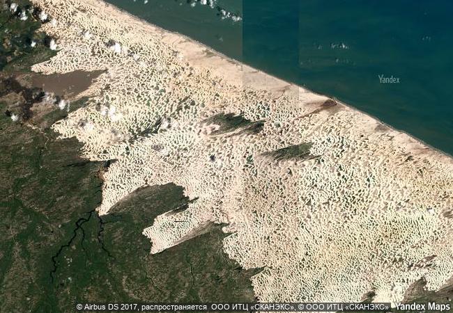
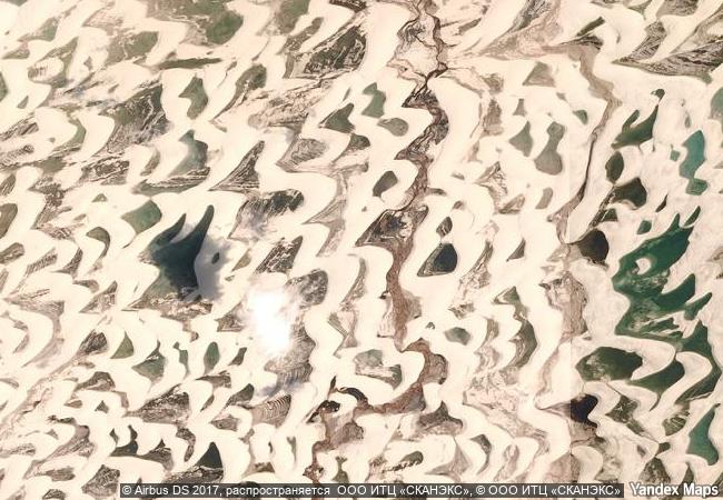
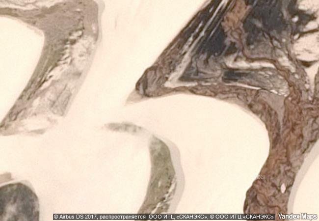
the property is located in northeastern brazil, on the east coast of maranhão, in a transition zone between three brazilian biomes: cerrado, caatinga and amazon. more than half of its area consists of a white coastal dune field with temporary and permanent lagoons. beyond its important role in biodiversity conservation, the park boasts globally significant aesthetic and geological/geomorphological values. along an 80 km coastline, with beaches followed by plains, the prevailing winds shape the dunes into long chains of barchans, filled in the rainy season to create lagoons of various colours, shapes, sizes and depths. the property reveals its best scenery when the lagoons reach their maximum volume, creating rare beauty. the vast expanse of both stable and shifting dunes, the largest in south america, presents remarkable evidence of the evolutionary progression of coastal dunes throughout the quaternary period.
8.32 M
(1)

Brazil
www.X-X-X.NAME
-2,53 ° × -43,06 °

2 ° 32 ′ 12 ″ S × 43 ° 04 ′ 49 ″ W
6.231.18 km

267 ° W
Brazil, Estado do Maranhão, pustynya Lensoyc-Maranyenses

Brazil / Caatinga / Estado do Maranhão / pustynya Lensoyc-Maranyenses
Great Barrier Reef

Off the east coast of the Queensland mainland

14.620.38 km
Chaîne des Puys - Limagne fault tectonic arena

Europe and North America

6.687.45 km
Vredefort Dome

Northwest and Free State provinces

13.544.16 km
Shark Bay, Western Australia

State of Western Australia

17.796.11 km
W-Arly-Pendjari Complex

Africa

8.781.89 km
Mount Sanqingshan National Park

Asia and the Pacific

12.052.47 km
Ancient and Primeval Beech Forests of the Carpathians and Other Regions of Europe

Europe and North America

7.715.93 km
Yakushima

Kamiyaku-cho and Yaku-cho, Kumage-gun Kagoshima Prefecture

11.469.48 km
Wadi Al-Hitan (Whale Valley)

Faiyum Governorate

9.679.07 km
Laurisilva of Madeira

Island of Madeira

5.830.19 km
Vjetrenica Cave, Ravno

Europe and North America

7.868.00 km
Gondwana Rainforests of Australia

States of New South Wales and Queensland

15.035.69 km

©

1 X ™


BRAND COM CORP GLOBAL INT

AAA BASE GRAND HIGH ORIGINAL QUALITY TOP UNIQUE

X-X-X•NAME
1 X ™ unesco
Info
Map
similar
language
guest


1 X
-4
IP : America/New_York
-4
IP : America/New_York