X xXx 1
unesco


Kuk Early Agricultural Site

Asia and the Pacific

13.961.16 km
0

Kuk Early Agricultural Site


Identifier 887
states pg
category cultural
criteria (iii)(iv)
Title kuk early agricultural site
latitude -5.7837109566
longitude 144.3317260742
Region asia and the pacific
year 2008
unique number 1546
description 
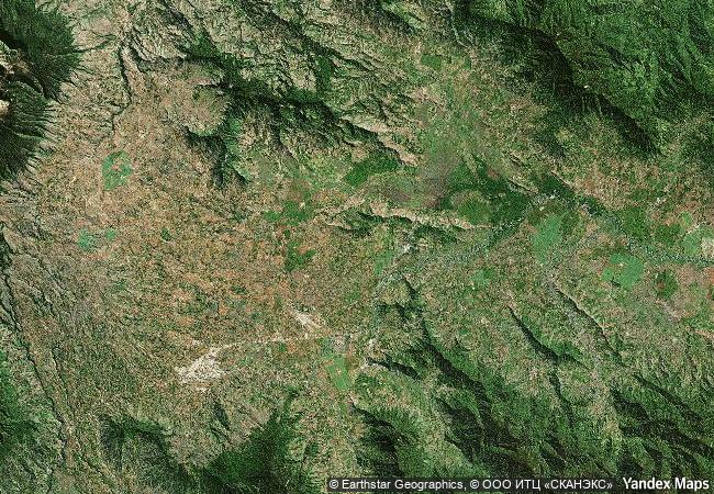
kuk early agricultural site consists of 116 ha of swamps in the western highlands of new guinea 1,500 metres above sea-level. archaeological excavation has revealed the landscape to be one of wetland reclamation worked almost continuously for 7,000, and possibly for 10,000 years. it contains well-preserved archaeological remains demonstrating the technological leap which transformed plant exploitation to agriculture around 6,500 years ago. it is an excellent example of transformation of agricultural practices over time, from cultivation mounds to draining the wetlands through the digging of ditches with wooden tools. kuk is one of the few places in the world where archaeological evidence suggests independent agricultural development and changes in agricultural practice over such a long period of time.
4.3 M

Papua New Guinea
www.X-X-X.NAME
-5.7837109566 ° × 144.3317260742 °

5 ° 47 ′ 01 ″ S × 144 ° 20 ′ 54 ″ E
13.961.16 km

126 ° SE
Papua New Guinea, Western Highlands Province

Pacifiс Ocean / Melanesia / New Guinea Island / Papua New Guinea / New Guinea Highlands / Western Highlands Province
Sceilg Mhichíl

County Kerry

5.521.06 km
Historic Centre of Zacatecas

Zacatecas State, Zacatecas Municipality

2.653.18 km
Town Hall and Roland on the Marketplace of Bremen

Bremen (city-state)

6.679.84 km
Archaeological Areas of Pompei, Herculaneum and Torre Annunziata

Province of Naples, Campania

7.773.09 km
Island of Mozambique

Ilha de Mocambique District, Nampula Province

13.932.03 km
Petroglyphic Complexes of the Mongolian Altai

Asia and the Pacific

10.050.01 km
Masada

Europe and North America

9.862.31 km
Archaeological Sites of the Island of Meroe

Arab States

10.919.44 km
Osun-Osogbo Sacred Grove

Osogbo, Osun State

9.247.40 km
The Ancient Town of Si Thep and its Associated Dvaravati Monuments

Asia and the Pacific

13.836.71 km
Choirokoitia

District of Larnaca

9.451.49 km
Lushan National Park

Jiujiang City, Jiangxi Province

12.056.03 km

©

1 X ™


BRAND COM CORP GLOBAL INT

AAA BASE GRAND HIGH ORIGINAL QUALITY TOP UNIQUE

X-X-X•NAME
1 X ™ unesco
Info
Map
similar
language
guest


1 X
-4
IP : America/New_York
-4
IP : America/New_York