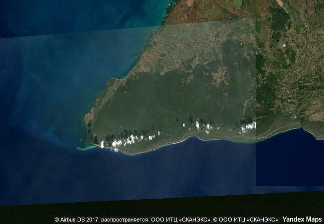
Desembarco del Granma National Park
Desembarco del Granma National Park, south-east corner of the the Republic of Cuba
|

|
Identifier |
889 |
|

|
states |
cu |
|

|
category |
natural |
|

|
criteria |
(vii)(viii) |
|

|
Title |
desembarco del granma national park |
|

|
latitude |
19.8833293915 |
|

|
longitude |
-77.6333312988 |
|

|
location |
desembarco del granma national park, south-east corner of the the republic of cuba |
|

|
Region |
latin america and the caribbean |
|

|
year |
1999 |
|

|
unique number |
1041 |
|

|
description |
desembarco del granma national park, with its uplifted marine terraces and associated ongoing development of karst topography and features, represents a globally significant example of geomorphologic and physiographic features and ongoing geological processes. the area, which is situated in and around cabo cruz in south-east cuba, includes spectacular terraces and cliffs, as well as some of the most pristine and impressive coastal cliffs bordering the western atlantic. |
|

|
justification |
the uplifted marine terraces of the desembarco del granma national park and associated ongoing development of karst topography and features, represent a globally significant example of geomorphologic and physiographic features and ongoing geological processes. the area includes spectacular stair-step terraces and cliffs and the ecosystems that have evolved on them, as well as some of the most pristine and impressive coastal cliffs bordering the western atlantic between the canadian maritimes and southern south america. |
|


 0
0


 1 X ™ unesco
 Info
Info
 Map
Map
 similar
 language