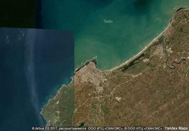
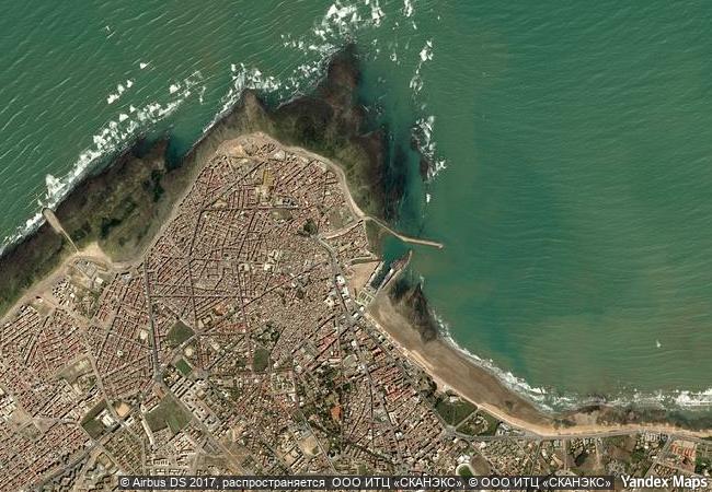
Portuguese City of Mazagan (El Jadida)
Region: Doukkala-Abda, Province El Jadida
|

|
Identifier |
1058 |
|

|
states |
ma |
|

|
category |
cultural |
|

|
criteria |
(ii)(iv) |
|

|
Title |
portuguese city of mazagan (el jadida) |
|

|
latitude |
33.2566719055 |
|

|
longitude |
-8.5019397736 |
|

|
location |
region: doukkala-abda, province el jadida |
|

|
Region |
arab states |
|

|
year |
2004 |
|

|
unique number |
1234 |
|

|
description |
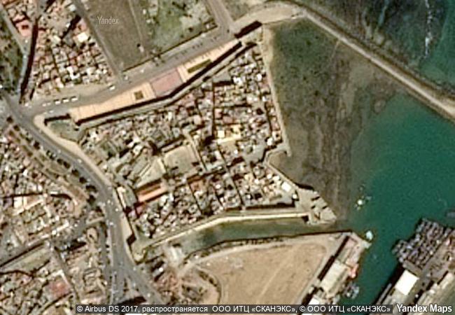
the portuguese fortification of mazagan, now part of the city of el jadida, 90-km southwest of casablanca, was built as a fortified colony on the atlantic coast in the early 16th century. it was taken over by the moroccans in 1769. the fortification with its bastions and ramparts is an early example of renaissance military design. the surviving portuguese buildings include the cistern and the church of the assumption, built in the manueline style of late gothic architecture. the portuguese city of mazagan - one of the early settlements of the portuguese explorers in west africa on the route to india - is an outstanding example of the interchange of influences between european and moroccan cultures, well reflected in architecture, technology, and town planning. |
|

|
justification |
criterion (ii): the portuguese city of mazagan is an outstanding example of the interchange of influences between european and moroccan cultures, and one of the early settlements of the portuguese explorers in west africa, on the route to india. these influences are well reflected in architecture, technology, and town planning.
criterion (iv): the portuguese fortified city of mazagan is an outstanding and early example of the realisation of the renaissance ideals integrated with portuguese construction technology. notable buildings from the portuguese period include: the cistern, and the church of the assumption, built in the manueline style of the early 16th century. |
|


 0
0


 1 X ™ unesco
 Info
Info
 Map
Map
 similar
 language