xXx X 1
unesco


Old town of Regensburg with Stadtamhof

Bavaria

7.103.76 km
0

Old town of Regensburg with Stadtamhof


Bavaria
Identifier 1155
states de
category cultural
criteria (ii)(iii)(iv)
Title old town of regensburg with stadtamhof
latitude 49.0205574036
longitude 12.0991668701
location bavaria
Region europe and north america
year 2006
unique number 1335
description 
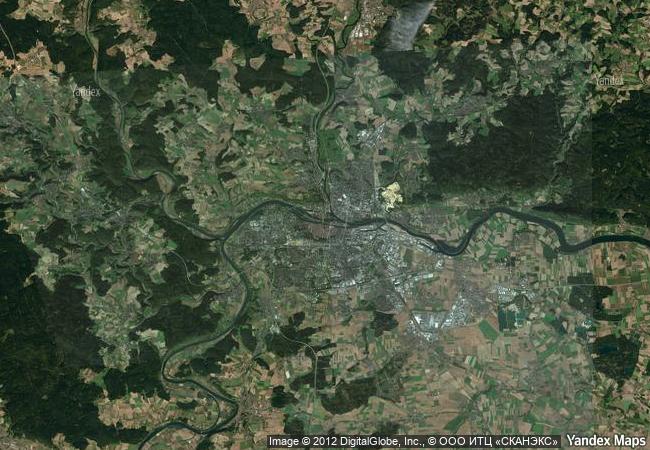
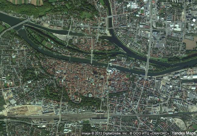
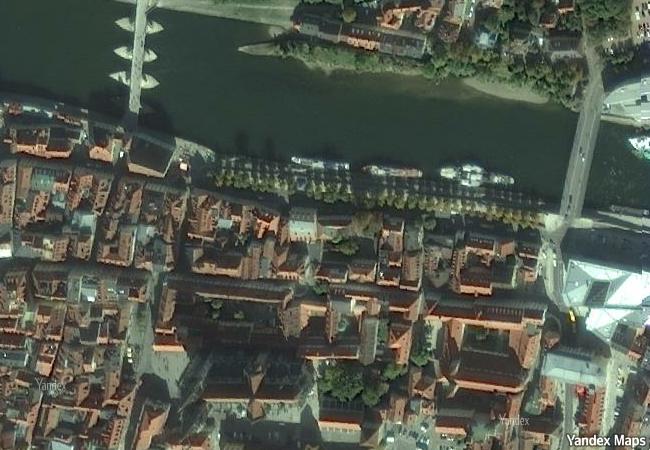
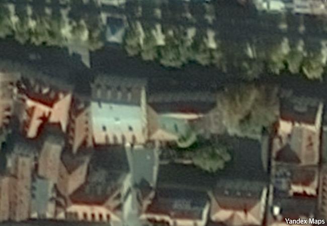
located on the danube river in bavaria, this medieval town contains many buildings of exceptional quality that testify to its history as a trading centre and to its influence on the region from the 9th century. a notable number of historic structures span some two millennia and include ancient roman, romanesque and gothic buildings. regensburg’s 11th- to 13th-century architecture – including the market, city hall and cathedral – still defines the character of the town marked by tall buildings, dark and narrow lanes, and strong fortifications. the buildings include medieval patrician houses and towers, a large number of churches and monastic ensembles as well as the 12th-century old bridge. the town is also remarkable for the vestiges testifing to its rich history as one of the centres of the holy roman empire that turned to protestantism.
2.12 M
(1)

Germany
503.3 K

Regensburg
www.X-X-X.NAME
49,02 ° × 12,09 °

49 ° 01 ′ 14 ″ N × 12 ° 06 ′ 57 ″ E
7.103.76 km

28 ° NE
Germany, Free State of Bavaria, Regensburg, Thundorferstraße

Germany / Free State of Bavaria / Regensburg / Thundorferstraße
Hegmataneh

Asia and the Pacific

10.330.26 km
Studenica Monastery

Village of Studenica, Commune of Kraljevo, Raška District, Republic of Serbia

7.987.14 km
Modernist Kaunas: Architecture of Optimism, 1919-1939

Europe and North America

7.406.06 km
Gordion

Europe and North America

8.981.03 km
Complex of Koguryo Tombs

Pyongyang, South Phyongan Province, Nampho, South Hwangghae Province

10.785.88 km
Richtersveld Cultural and Botanical Landscape

Northern Cape

12.816.42 km
Memphis and its Necropolis – the Pyramid Fields from Giza to Dahshur

Governorate of Giza

9.692.57 km
Rila Monastery

On the slopes of Rila, the highest Balkan Peninsula Mountain, in the valley of the Rilska River, 29 km east of the Sofia-Thessaloniki Highway. Rila, Kyustendil Province

8.259.72 km
Arslantepe Mound

Europe and North America

9.458.58 km
Archaeological Site of Leptis Magna

District of Khoms

8.302.75 km
Al Zubarah Archaeological Site

Arab States

11.274.83 km
Dazu Rock Carvings

Dazu County, Chongqing Municipality

12.216.74 km

©

1 X ™


BRAND COM CORP GLOBAL INT

AAA BASE GRAND HIGH ORIGINAL QUALITY TOP UNIQUE

X-X-X•NAME
1 X ™ unesco
Info
Map
similar
language
guest


1 X
-4
IP : America/New_York
-4
IP : America/New_York