xXx 1 X
2
unesco


Le Morne Cultural Landscape

Africa

15.679.53 km
0

Le Morne Cultural Landscape


Identifier 1259
states mu
category cultural
criteria (iii)(vi)
Title le morne cultural landscape
latitude -20.4519443512
longitude 57.3283348083
Region africa
year 2008
unique number 1860
description 
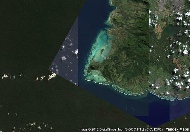
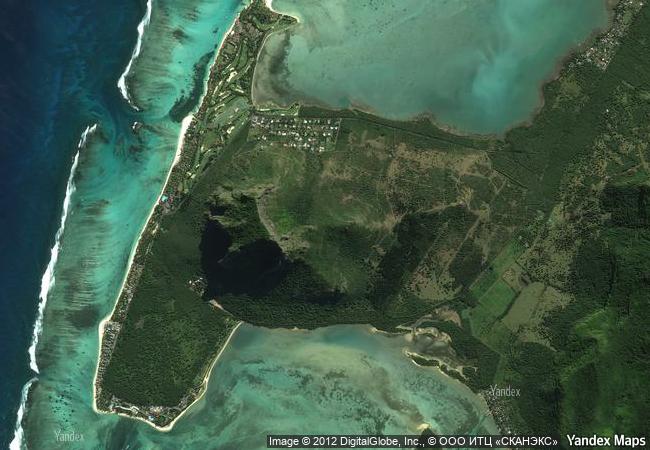
le morne cultural landscape, a rugged mountain that juts into the indian ocean in the southwest of mauritius was used as a shelter by runaway slaves, maroons, through the 18th and early years of the 19th centuries. protected by the mountain’s isolated, wooded and almost inaccessible cliffs, the escaped slaves formed small settlements in the caves and on the summit of le morne. the oral traditions associated with the maroons, have made le morne a symbol of the slaves’ fight for freedom, their suffering, and their sacrifice, all of which have relevance to the countries from which the slaves came - the african mainland, madagascar, india, and south-east asia. indeed, mauritius, an important stopover in the eastern slave trade, also came to be known as the “maroon republic” because of the large number of escaped slaves who lived on le morne mountain.
8.62 M

Mauritius
www.X-X-X.NAME
-20,45 ° × 57,32 °

20 ° 27 ′ 07 ″ S × 57 ° 20 ′ 42 ″ E
15.679.53 km

357 ° N
Mauritius, Black River, Le Morne Brabant Peninsula

Indian Ocean / Mauritius / Mauritius Island / Black River / Le Morne Brabant Peninsula
Thracian Tomb of Sveshtari

Razgrad Province

8.352.77 km
The Architectural Work of Le Corbusier, an Outstanding Contribution to the Modern Movement

Latin America and the Caribbean

6.910.67 km
Þingvellir National Park

Bláskógabyggð municipality, district of Arnessysla

4.747.30 km
Gobustan Rock Art Cultural Landscape

Garadagh District and Apsheron District, Baku City Administrative Territory

9.887.24 km
Koh Ker: Archaeological Site of Ancient Lingapura or Chok Gargyar

Asia and the Pacific

13.988.10 km
Ancient City of Polonnaruwa

North Central Province, Polonnaruva District

14.443.16 km
Medina of Essaouira (formerly Mogador)

Province of Essaouira, Tensift Region

6.492.20 km
Hatra

Governorate of Ninawa

9.944.85 km
Alto Douro Wine Region

Douro Region, Trás-os-Montes e Alto Douro

6.145.79 km
Garrison Border Town of Elvas and its Fortifications

Europe and North America

6.304.19 km
Provins, Town of Medieval Fairs

Department of Seine-et-Marne, Ile-de-France

6.566.88 km
Historic Monuments and Sites in Kaesong

Asia and the Pacific

10.841.13 km

©

1 X ™


BRAND COM CORP GLOBAL INT

AAA BASE GRAND HIGH ORIGINAL QUALITY TOP UNIQUE

X-X-X•NAME
1 X ™ unesco
Info
Map
similar
language
guest


1 X
-4
IP : America/New_York
-4
IP : America/New_York