X 1 xXx ™
3
⬤
unesco
⬤


☆
La Chaux-de-Fonds / Le Locle, Watchmaking Town Planning

Europe and North America

6.569.79 km
☆
★★★★☆
0

La Chaux-de-Fonds / Le Locle, Watchmaking Town Planning


Identifier 1302
states ch
category cultural
criteria (iv)
Title la chaux-de-fonds / le locle, watchmaking town planning
latitude 47.1038894653
longitude 6.8327779770
Region europe and north america
year 2009
unique number 1582
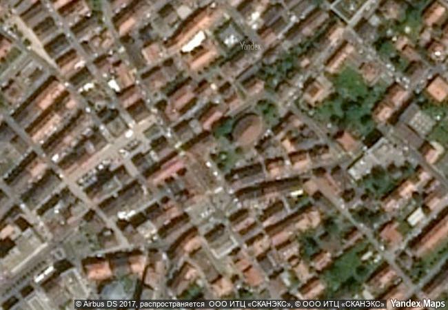
description the site of la chaux-de-fonds / le locle watchmaking town-planning consists of two towns situated close to one another in a remote environment in the swiss jura mountains, on land ill-suited to farming. their planning and buildings reflect watchmakers’ need of rational organization. planned in the early 19th century, after extensive fires, the towns owed their existence to this single industry. their layout along an open-ended scheme of parallel strips on which residential housing and workshops are intermingled reflects the needs of the local watchmaking culture that dates to the 17th century and is still alive today. the site presents outstanding examples of mono-industrial manufacturing-towns which are well preserved and still active. the urban planning of both towns has accommodated the transition from the artisanal production of a cottage industry to the more concentrated factory production of the late 19th and 20th centuries. the town of la chaux-de-fonds was described by karl marx as a “huge factory-town” in das kapital where he analyzed the division of labour in the watchmaking industry of the jura.
★
8.4 M

Switzerland
☆
198.2 K

La Chaux-de-Fonds
www.X-X-X.NAME
47,10 ° × 6,83 °

47 ° 06 ′ 14 ″ N × 6 ° 50 ′ 58 ″ E
6.569.79 km

209 ° SW
Switzerland, Neuchâtel, La Chaux-de-Fonds, Rue de la Terrasse

Switzerland / Jura Mountains / Neuchâtel / La Chaux-de-Fonds / Rue de la Terrasse
☆
Golestan Palace

Asia and the Pacific

10.191.23 km
☆
Serra da Capivara National Park

Sud-est de Etat du Piaui – Communes de Sao Raimundo Nonato, Sao Joao do Piaui et Canto do Butriti

6.413.80 km
☆
Ban Chiang Archaeological Site

Udon Thani Province

13.737.51 km
☆
Ancient Ksour of Ouadane, Chinguetti, Tichitt and Oualata

Oudane, Chinguetti: region de l’Adrar; Tichitt: region du Tagant; Oualata: region du Hodh Echchargut

6.511.30 km
☆
Archaeological Site of Aigai (modern name Vergina)

Prefecture of Imathia, Region of Central Macedonia

8.011.29 km
☆
Heart of Neolithic Orkney

Mainland Orkney, Scotland
Multiple locations

5.514.74 km
☆
Palace and Park of Versailles

Department of Yvelines, Ile-de-France

6.172.35 km
☆
Chavin (Archaeological Site)

Ancash Department, Huari Province, Chavin District

5.408.22 km
☆
Jongmyo Shrine

Seoul

11.135.32 km
☆
Red Fort Complex

New Delhi State, Central District, New Delhi

12.044.07 km
☆
Citadel, Ancient City and Fortress Buildings of Derbent

Dagestan, Eastern Caucasus, Western coast of Caspian Sea

9.466.20 km
☆
Archaeological Sites of Mycenae and Tiryns

Prefecture of Argolis, Region of the Peloponnesos

8.223.82 km

©

1 X ™


BRAND • COM • CORP • GLOBAL • INT

AAA • BASE • GRAND • HIGH • ORIGINAL • QUALITY • TOP • UNIQUE

™X-X-X•NAME
1 X ™ unesco
Info
Map
similar
language
▼ ▼ ▼
guest


1 X
™
-4
IP : America/New_York
-4
IP : America/New_York
▼ ▼ ▼
►
►