xXx X 1
5
unesco


Prehistoric Caves of Yagul and Mitla in the Central Valley of Oaxaca

Latin America and the Caribbean

2.867.33 km
0

Prehistoric Caves of Yagul and Mitla in the Central Valley of Oaxaca


Identifier 1352
states mx
category cultural
criteria (iii)
Title prehistoric caves of yagul and mitla in the central valley of oaxaca
latitude 16.9508323669
longitude -96.4211120605
Region latin america and the caribbean
year 2010
unique number 1693
description 
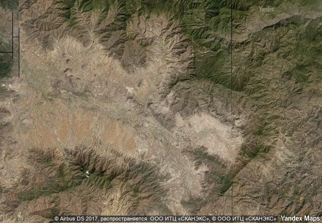
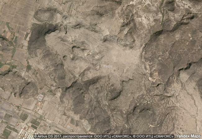
this property lies on the northern slopes of the tlacolula valley in subtropical central oaxaca and consists of two pre-hispanic archaeological complexes and a series of pre-historic caves and rock shelters. some of these shelters provide archaeological and rock-art evidence for the progress of nomadic hunter-gathers to incipient farmers. ten thousand-year-old cucurbitaceae seeds in one cave, guilá naquitz, are considered to be the earliest known evidence of domesticated plants in the continent, while corn cob fragments from the same cave are said to be the earliest documented evidence for the domestication of maize. the cultural landscape of the prehistoric caves of yagul and mitla demonstrates the link between man and nature that gave origin to the domestication of plants in north america, thus allowing the rise of mesoamerican civilizations.
3.65 M

Mexico
www.X-X-X.NAME
16,95 ° × -96,42 °

16 ° 57 ′ 03 ″ N × 96 ° 25 ′ 16 ″ W
2.867.33 km

17 ° N>NE
Mexico, Oaxaca

Mexico / Sierra Madre del Sur / Oaxaca
Summer Palace, an Imperial Garden in Beijing

10 km northwest of Beijing

10.923.69 km
Forts and Castles, Volta, Greater Accra, Central and Western Regions

Volta, Greater Accra, Central and Western Regions

8.985.19 km
Sado Island Gold Mines

Asia and the Pacific

10.376.99 km
Caliphate City of Medina Azahara

Europe and North America

6.532.78 km
Renaissance Monumental Ensembles of Úbeda and Baeza

Province of Jaen, Autonomous Community of Andalusia

6.640.88 km
Viking-Age Ring Fortresses

Europe and North America

6.507.37 km
Medina of Essaouira (formerly Mogador)

Province of Essaouira, Tensift Region

6.492.20 km
Town of Bamberg

District of Upper Franconia

6.978.75 km
Ancient City of Bosra

Governorate of Deraa

9.834.69 km
Funerary and memory sites of the First World War (Western Front)

Europe and North America

9.412.08 km
Garden Kingdom of Dessau-Wörlitz

State of Saxony-Anhalt (Sachsen-Anhalt)

6.960.41 km
Rietveld Schröderhuis (Rietveld Schröder House)

City and Province of Utrecht

6.509.43 km

©

1 X ™


BRAND COM CORP GLOBAL INT

AAA BASE GRAND HIGH ORIGINAL QUALITY TOP UNIQUE

X-X-X•NAME
1 X ™ unesco
Info
Map
similar
language
guest


1 X
-4
IP : America/New_York
-4
IP : America/New_York