X 1 xXx
unesco


Sado Island Gold Mines

Asia and the Pacific

10.376.99 km
0

Sado Island Gold Mines


Identifier 1698
states jp
category cultural
criteria (iv)
Title sado island gold mines
latitude 38.0408325195
longitude 138.2577819824
Region asia and the pacific
year 2024
unique number 2544
description 
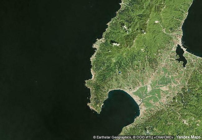
the sado island gold mines are a serial property located on sado island, some thirty-five kilometres west of the niigata prefecture coast. it is formed of several component parts illustrative of different unmechanised mining methods. sado island is of volcanic origin and features two parallel mountain ranges stretching from southwest to northeast and separated by one alluvial plain, the kuninaka plain. gold and silver deposits were formed by the rising of hydrothermal water to the land surface and forming veins in the rock; tectonic activity first submerged the surface deposits to the seabed, which was later raised again by tectonic movements. placer deposits were exploited in nishimikawa area, located on the north-western side of the kosado mountains. in addition, the weathering of the volcanic rock exposed ore veins, which were mined underground in the aikawa-tsurushi area, at the southern end of the osado mountains range. mostly tangible attributes reflecting mining activities and social and labour organisation are preserved as archaeological elements, both above and below ground, and landscape features.
2.27 M
(1)

Japan
www.X-X-X.NAME
38,04 ° × 138,25 °

38 ° 02 ′ 27 ″ N × 138 ° 15 ′ 28 ″ E
10.376.99 km

111 ° E>SE
Japan, Niigata Prefecture, Sado, Sado Island

Pacifiс Ocean / Japan / Japanese archipelago / Chubu Region / Hokuriku Region / Niigata Prefecture / Sado / Sado Island
Aqueduct of Padre Tembleque Hydraulic System

Latin America and the Caribbean

2.689.98 km
Royal Palaces of Abomey

Province du Zou

9.069.32 km
Kernavė Archaeological Site (Cultural Reserve of Kernavė)

Vilnius county, Širvintos district, Kernave town.

7.454.28 km
Rideau Canal

Province of Ontario

815.28 km
City of Bath

Avon, England

6.068.96 km
Itchan Kala

Khorezm region, Khiva

10.243.03 km
The work of engineer Eladio Dieste: Church of Atlántida

Latin America and the Caribbean

8.764.20 km
Royal Botanic Gardens, Kew

London Borough of Richmond upon Thames, southwest Greater London

6.196.96 km
Sanctuary of Bom Jesus do Congonhas

State of Minas Gerais, City of Congonhas

7.853.22 km
Kunta Kinteh Island and Related Sites

Lower Niumi and Upper Niumi districts
and Banjul Municipality

7.079.60 km
Seokguram Grotto and Bulguksa Temple

Asia and the Pacific

10.963.99 km
Mount Qingcheng and the Dujiangyan Irrigation System

Dujiangyan City, Sichuan Province

12.094.80 km

©

1 X ™


BRAND COM CORP GLOBAL INT

AAA BASE GRAND HIGH ORIGINAL QUALITY TOP UNIQUE

X-X-X•NAME
1 X ™ unesco
Info
Map
similar
language
guest


1 X
-4
IP : America/New_York
-4
IP : America/New_York