X xXx 1
1
unesco


Røros Mining Town and the Circumference

Europe and North America

6.350.07 km
0

Røros Mining Town and the Circumference


Identifier 55
states no
category cultural
criteria (iii)(iv)(v)
Title røros mining town and the circumference
latitude 62.5738906860
longitude 11.3855562210
Region europe and north america
year 1980
unique number 1667
description 
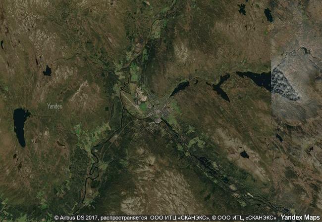
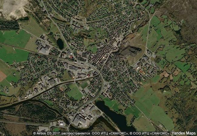
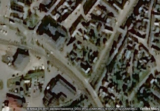
røros mining town and the circumference is linked to the copper mines, established in the 17th century and exploited for 333 years until 1977. the site comprises the town and its industrial-rural cultural landscapes; femundshytta, a smelter with its associated area; and the winter transport route. completely rebuilt after its destruction by swedish troops in 1679, røros contains about 2000 wooden one- and two-storey houses and a smelting house. many of these buildings have preserved their blackened wooden façades, giving the town a medieval appearance. surrounded by a buffer zone, coincident with the area of privileges (the circumference) granted to the mining enterprise by the danish-norwegian crown (1646), the property illustrates the establishment and flourishing of a lasting culture based on copper mining in a remote region with a harsh climate.
extension 1
3.3 M

Norway

Røros
www.X-X-X.NAME
62.573890686 ° × 11.385556221 °

62 ° 34 ′ 26 ″ N × 11 ° 23 ′ 08 ″ E
6.350.07 km

166 ° S
Norway, Trøndelag, Røros kommune, Røros

Norway / Scandinavian Mountains / Trøndelag / Røros kommune / Røros
La Fortaleza and San Juan National Historic Site in Puerto Rico

San Juan, Puerto Rico

2.886.36 km
Old town of Regensburg with Stadtamhof

Bavaria

7.103.76 km
The Historic Centre (Chorá) with the Monastery of Saint-John the Theologian and the Cave of the Apocalypse on the Island of Pátmos

Prefecture of Dodecanese, Region of the South Aegean

8.821.22 km
Routes of Santiago de Compostela in France

Regions of Aquitaine, Auvergne, Basse-Normandie, Bourgogne, Centre, Champagne-Ardenne, Ile-de-France, Languedoc-Roussillon, Limousin, Midi-Pyrénées, Picardie, Poitou-Charentes, and Provence-Alpes-Côte d’Azur

6.563.52 km
Rock Carvings in Tanum

Bohuslan

6.533.76 km
The Cathedral of St James in Šibenik

County of Šibenik-Knin

7.672.27 km
Bourges Cathedral

Department of Cher, Centre Region

6.581.69 km
Medina of Sousse

Gouvernorat de Sousse

7.821.31 km
Fort and Shalamar Gardens in Lahore

Lahore, Punjab

11.722.39 km
Las Médulas

Province of Léon, Autonomous Community of Castile-Leon

6.157.51 km
Pergamon and its Multi-Layered Cultural Landscape

Europe and North America

8.723.89 km
Hidden Christian Sites in the Nagasaki Region

Asia and the Pacific

11.283.48 km

©

1 X ™


BRAND COM CORP GLOBAL INT

AAA BASE GRAND HIGH ORIGINAL QUALITY TOP UNIQUE

X-X-X•NAME
1 X ™ unesco
Info
Map
similar
language
guest


1 X
-4
IP : America/New_York
-4
IP : America/New_York