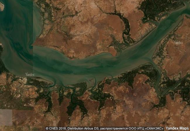
Kunta Kinteh Island and Related Sites
Lower Niumi and Upper Niumi districts
and Banjul Municipality
|

|
Identifier |
761 |
|

|
states |
gm |
|

|
category |
cultural |
|

|
criteria |
(iii)(vi) |
|

|
Title |
kunta kinteh island and related sites |
|

|
latitude |
13.3161668777 |
|

|
longitude |
-16.3571949005 |
|

|
location |
lower niumi and upper niumi districts
and banjul municipality |
|

|
Region |
africa |
|

|
year |
2003 |
|

|
unique number |
897 |
|

|
description |
james island and related sites present a testimony to the main periods and facets of the encounter between africa and europe along the river gambia, a continuum stretching from pre-colonial and pre-slavery times to independence. the site is particularly significant for its relation to the beginning of the slave trade and its abolition. it also documents early access to the interior of africa. |
|

|
justification |
criterion iii: james island and related sites on the river gambia provide an exceptional testimony to the different facets of the african-european encounter, from the 15th to 20th centuries. the river gambia formed the first trade route into the interior of africa and became an early corridor for the slave trade. criterion vi: james island and related sites, the villages and the batteries, were directly and tangibly associated with the beginning and the conclusion of the slave trade, retaining its memory related to the african diaspora. |
|


 0
0


 1 X ™ unesco
 Info
Info
 Map
Map
 similar
 language