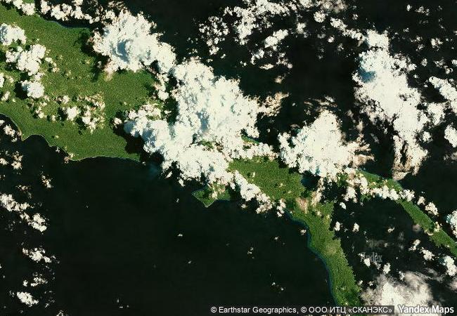
East Rennell
Southernmost of the Solomon Islands, Rennell and Bellona Province
|

|
Identifier |
854 |
|

|
states |
sb |
|

|
category |
natural |
|

|
criteria |
(ix) |
|

|
Title |
east rennell |
|

|
latitude |
-11.6833295822 |
|

|
longitude |
160.3333282471 |
|

|
location |
southernmost of the solomon islands, rennell and bellona province |
|

|
Region |
asia and the pacific |
|

|
year |
1998 |
|

|
unique number |
1005 |
|

|
description |
east rennell makes up the southern third of rennell island, the southernmost island in the solomon island group in the western pacific. rennell, 86 km long x 15 km wide, is the largest raised coral atoll in the world. the site includes approximately 37,000 ha and a marine area extending 3 nautical miles to sea. a major feature of the island is lake tegano, which was the former lagoon on the atoll. the lake, the largest in the insular pacific (15,500 ha), is brackish and contains many rugged limestone islands and endemic species. rennell is mostly covered with dense forest, with a canopy averaging 20 m in height. combined with the strong climatic effects of frequent cyclones, the site is a true natural laboratory for scientific study. the site is under customary land ownership and management. |
|

|
justification |
criterion (ix): east rennell, as a stepping stone in the migration and evolution of species in the western pacific, is an important site for the science of island biogeography. combined with the strong climate effects of frequent cyclones, east rennell is a true natural laboratory for scientific study. |
|

|
danger |
y 2013 |
|


 0
0


 1 X ™ unesco
 Info
Info
 Map
Map
 similar
 language