X 1 xXx
2
unesco


Masada

Europe and North America

9.862.31 km
0

Masada


Identifier 1040
states il
category cultural
criteria (iii)(iv)(vi)
Title masada
latitude 31.3155555725
longitude 35.3536109924
Region europe and north america
year 2001
unique number 1214
description 
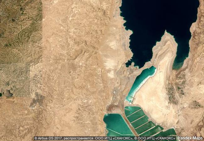
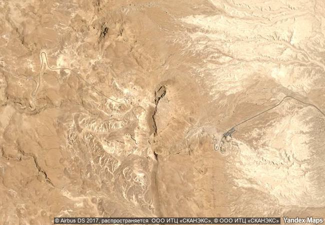
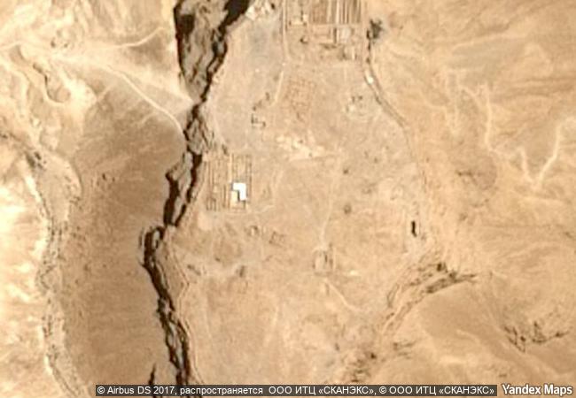
masada is a rugged natural fortress, of majestic beauty, in the judaean desert overlooking the dead sea. it is a symbol of the ancient kingdom of israel, its violent destruction and the last stand of jewish patriots in the face of the roman army, in 73 a.d. it was built as a palace complex, in the classic style of the early roman empire, by herod the great, king of judaea, (reigned 37 – 4 b.c.). the camps, fortifications and attack ramp that encircle the monument constitute the most complete roman siege works surviving to the present day.
justification criterion (iii): masada is a symbol of the ancient jewish kingdom of israel, of its violent destruction in the later 1st century ce, and of the subsequent diaspora. criterion (iv): the palace of herod the great at masada is an outstanding example of a luxurious villa of the early roman empire, whilst the camps and other fortifications that encircle the monument constitute the finest and most complete roman siege works to have survived to the present day. criterion (vi): the tragic events during the last days of the jewish refugees who occupied the fortress and palace of masada make it a symbol both of jewish cultural identity and, more universally, of the continuing human struggle between oppression and liberty.
7.2 M

Israel
www.X-X-X.NAME
31.3155555725 ° × 35.3536109924 °

31 ° 19 ′ 56 ″ N × 35 ° 21 ′ 13 ″ E
9.862.31 km

248 ° W
Israel, Southern District, Be`er Sheva Subdistrict, Dead Sea Region

Israel / Southern District / Negev / Be`er Sheva Subdistrict / Dead Sea Region
Church and Dominican Convent of Santa Maria delle Grazie with “The Last Supper” by Leonardo da Vinci

Province of Milano, Lombardy

7.123.19 km
Budj Bim Cultural Landscape

Asia and the Pacific

16.172.52 km
Rideau Canal

Province of Ontario

815.28 km
Richtersveld Cultural and Botanical Landscape

Northern Cape

12.816.42 km
Cultural Landscape of Honghe Hani Rice Terraces

Asia and the Pacific

12.977.95 km
Krzemionki Prehistoric Striped Flint Mining Region

Europe and North America

7.537.91 km
Historical Monuments of Mtskheta

City of Mtskheta, Region of Mtskheta-Mtianeti

9.503.32 km
Historic City of Sucre

Department de Chuquisaca, Province Oropeza

6.814.92 km
Earliest 16th-Century Monasteries on the Slopes of Popocatepetl

Latin America and the Caribbean

2.789.04 km
Wooden Churches of Southern Małopolska

Gorlice, Nowy Targ, and Bochnia counties, Voivodship of Lesser Poland (Malopolskie); Brzozów County, Subcarpathian (Podkarpackie) Voivodship

7.603.85 km
Frontiers of the Roman Empire – The Danube Limes (Western Segment)

Europe and North America

7.451.78 km
Sacred Island of Okinoshima and Associated Sites in the Munakata Region

Asia and the Pacific

11.091.14 km

©

1 X ™


BRAND COM CORP GLOBAL INT

AAA BASE GRAND HIGH ORIGINAL QUALITY TOP UNIQUE

X-X-X•NAME
1 X ™ unesco
Info
Map
similar
language
guest


1 X
-4
IP : America/New_York
-4
IP : America/New_York