X xXx 1
unesco


Mathildenhöhe Darmstadt

Europe and North America

6.841.79 km
0

Mathildenhöhe Darmstadt


Identifier 1614
states de
category cultural
criteria (ii)(iv)
Title mathildenhöhe darmstadt
latitude 49.8763885498
longitude 8.6674995422
Region europe and north america
year 2021
unique number 2326
description 
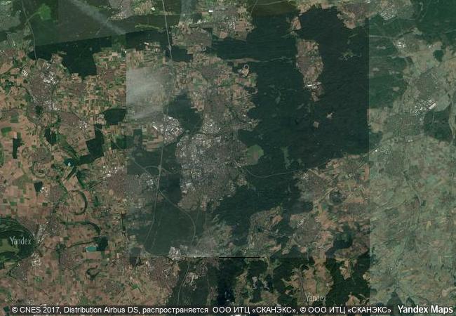
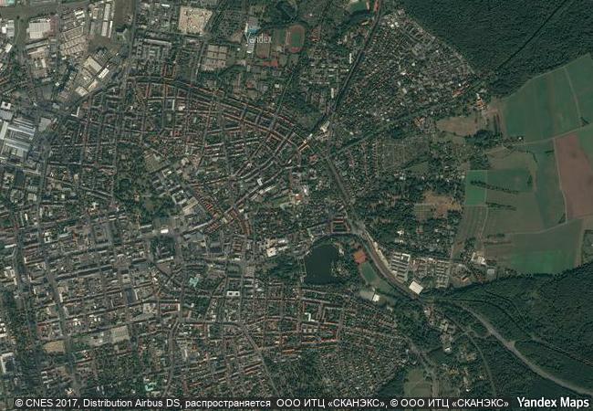
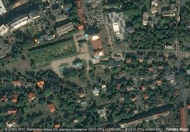
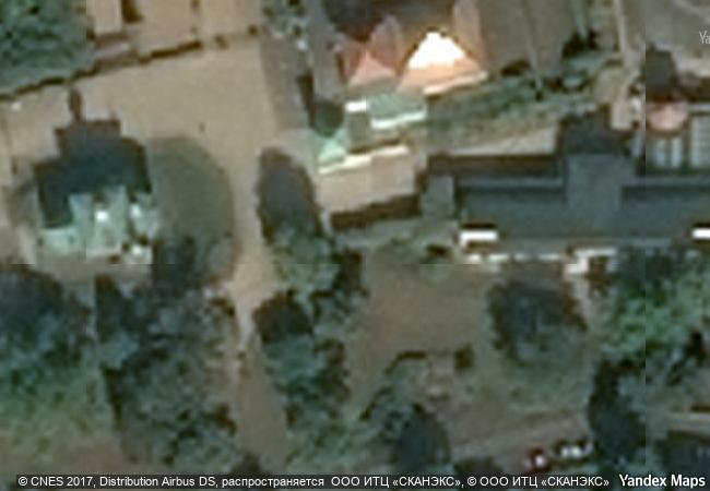
the darmstadt artists’ colony on mathildenhöhe, the highest elevation above the city of darmstadt in west-central germany, was established in 1897 by ernst ludwig, grand duke of hesse, as a centre for emerging reform movements in architecture, arts and crafts. the buildings of the colony were created by its artist members as experimental early modernist living and working environments. the colony was expanded during successive international exhibitions in 1901, 1904, 1908 and 1914. today, it offers a testimony to early modern architecture, urban planning and landscape design, all of which were influenced by the arts and crafts movement and the vienna secession. the serial property consists of two component parts including 23 elements, such as the wedding tower (1908), the exhibition hall (1908), the plane tree grove (1833, 1904-14), the russian chapel of st. maria magdalena (1897-99), the lily basin, the gottfried schwab memorial (1905), the pergola and garden (1914), the “swan temple” garden pavilion (1914), the ernst ludwig fountain, and the 13 houses and artists’ studios that were built for the darmstadt artists’ colony and for the international exhibitions. a three house group, built for the 1904 exhibition is an additional component.
9.2 M
(1)

Germany
465.6 K

Darmstadt
www.X-X-X.NAME
49.8763885498 ° × 8.6674995422 °

49 ° 53 ′ 35 ″ N × 8 ° 40 ′ 03 ″ E
6.841.79 km

329 ° N>NW
Germany, State of Hessen, Darmstadt, Europapaltz

Germany / State of Hessen / Darmstadt / Europapaltz
Margravial Opera House Bayreuth

Europe and North America

7.018.12 km
Durham Castle and Cathedral

County of Durham, England

5.982.67 km
Monuments of Oviedo and the Kingdom of the Asturias

Province and Autonomous Community of Asturias

6.183.66 km
Itsukushima Shinto Shrine

Hiroshima Prefecture

10.997.13 km
Abbey of St Gall

Canton of St Gall, Town of St Gall

7.023.84 km
Belfries of Belgium and France

Europe and North America

6.482.55 km
Cornwall and West Devon Mining Landscape

Cornwall and Devon Counties

5.921.28 km
Historic Centre of the Town of Olinda

State of Pernambuco, North-East Region of Brazil

7.268.98 km
Tr’ondëk-Klondike

Europe and North America

4.478.20 km
Old Towns of Djenné

Djenné Circle, Region of Mopti

8.044.18 km
Lednice-Valtice Cultural Landscape

Breclav District, South Moravian Region

7.404.68 km
Wooden Churches of the Slovak part of the Carpathian Mountain Area

Prešov, Žilina, Banská Bystrica and Košice Regions

7.534.09 km

©

1 X ™


BRAND COM CORP GLOBAL INT

AAA BASE GRAND HIGH ORIGINAL QUALITY TOP UNIQUE

X-X-X•NAME
1 X ™ unesco
Info
Map
similar
language
guest


1 X
-4
IP : America/New_York
-4
IP : America/New_York