1 X xXx
4
unesco


The Slate Landscape of Northwest Wales

Europe and North America

5.888.72 km
0

The Slate Landscape of Northwest Wales


Identifier 1633
states gb
category cultural
criteria (ii)(iv)
Title the slate landscape of northwest wales
latitude 53.1208343506
longitude -4.1149997711
Region europe and north america
year 2021
unique number 2371
description 
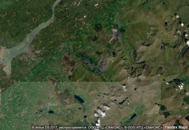
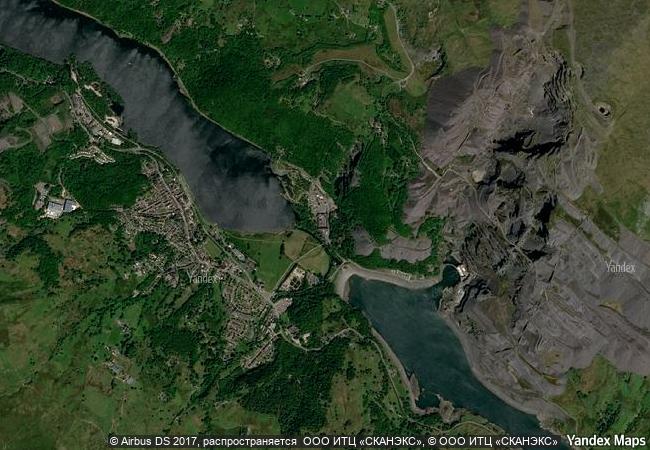
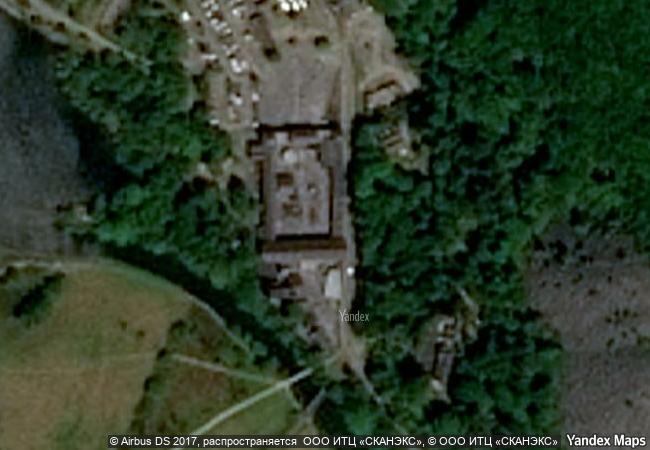
the slate landscape of northwest wales illustrates the transformation that industrial slate quarrying and mining brought about in the traditional rural environment of the mountains and valleys of the snowdon massif. the territory, extending from mountain-top to sea-coast, presented opportunities and constraints that were used and challenged by the large-scale industrial processes undertaken by landowners and capital investors, which reshaped the agricultural landscape into an industrial centre for slate production during the industrial revolution (1780-1914). the serial property comprises six components each encompassing relict quarries and mines, archaeological sites related to slate industrial processing, historical settlements, both living and relict, historic gardens and grand country houses, ports, harbours and quays, and railway and road systems illustrating the functional and social linkages of the relict slate industrial landscape. the property was internationally significant not only for the export of slates, but also for the export of technology and skilled workers from the 1780s to the early 20th century. it played a leading role in the field and constituted a model for other slate quarries in different parts of the world. it offers an important and remarkable example of interchange of materials, technology and human values. 
3.29 M

United Kingdom
www.X-X-X.NAME
53,12 ° × -4,11 °

53 ° 07 ′ 15 ″ N × 4 ° 07 ′ 54 ″ W
5.888.72 km

159 ° S
United Kingdom, Wales, Gwynedd

Atlantic Ocean / British Isles / United Kingdom / Great Britain / Wales / Gwynedd
Castel del Monte

Communes of Andria and Corato, Province of Bari, Puglia Region

7.871.95 km
Palestine: Land of Olives and Vines – Cultural Landscape of Southern Jerusalem, Battir

Arab States

9.816.97 km
Cueva de las Manos, Río Pinturas

Patagonia Region, Santa Cruz Province

9.763.26 km
Gebel Barkal and the Sites of the Napatan Region

Northern state, province of Meroe

10.652.20 km
Historic Centre of Rome, the Properties of the Holy See in that City Enjoying Extraterritorial Rights and San Paolo Fuori le Mura

Province of Roma, Lazio region (IT) / Vatican City State (VA)

7.564.14 km
Tr’ondëk-Klondike

Europe and North America

4.478.20 km
Cultural Landscape of Honghe Hani Rice Terraces

Asia and the Pacific

12.977.95 km
Skogskyrkogården

Stockholm County

6.841.78 km
City of Graz – Historic Centre and Schloss Eggenberg

Europe and North America

7.429.93 km
18th-Century Royal Palace at Caserta with the Park, the Aqueduct of Vanvitelli, and the San Leucio Complex

Provinces of Caserta and Benevento, Campania

7.741.33 km
Memorial sites of the Genocide: Nyamata, Murambi, Gisozi and Bisesero

Africa

12.092.67 km
Archaeological Sites of the Island of Meroe

Arab States

10.919.44 km

©

1 X ™


BRAND COM CORP GLOBAL INT

AAA BASE GRAND HIGH ORIGINAL QUALITY TOP UNIQUE

X-X-X•NAME
1 X ™ unesco
Info
Map
similar
language
guest


1 X
-4
IP : America/New_York
-4
IP : America/New_York