xXx 1 X
3
unesco


Cultural Landscape of Honghe Hani Rice Terraces

Asia and the Pacific

12.977.95 km
0

Cultural Landscape of Honghe Hani Rice Terraces


Identifier 1111
states cn
category cultural
criteria (iii)(v)
Title cultural landscape of honghe hani rice terraces
latitude 23.0932788849
longitude 102.7799835205
Region asia and the pacific
year 2013
unique number 1877
description 
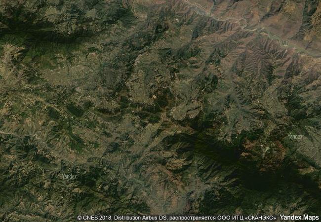
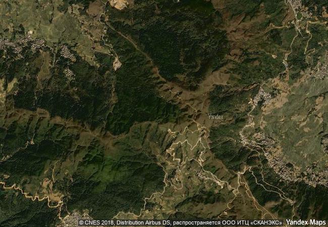
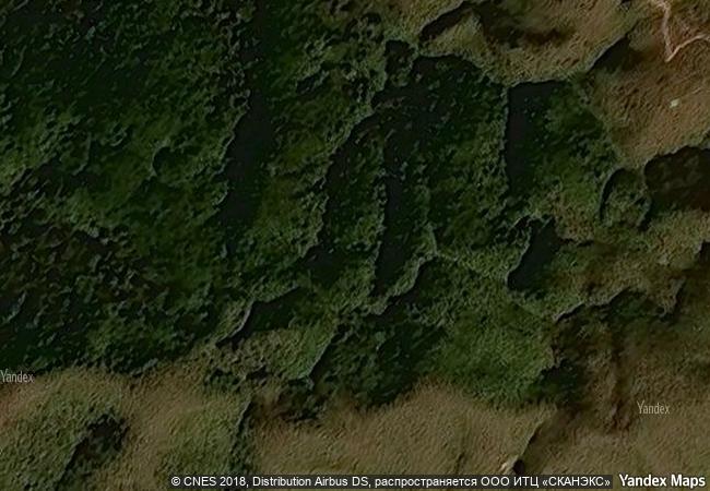
the cultural landscape of honghe hani rice terraces, china covers 16,603-hectares in southern yunnan. it is marked by spectacular terraces that cascade down the slopes of the towering ailao mountains to the banks of the hong river. over the past 1,300 years, the hani people have developed a complex system of channels to bring water from the forested mountaintops to the terraces. they have also created an integrated farming system that involves buffalos, cattle, ducks, fish and eel and supports the production of red rice, the area’s primary crop. the inhabitants worship the sun, moon, mountains, rivers, forests and other natural phenomena including fire. they live in 82 villages situated between the mountaintop forests and the terraces. the villages feature traditional thatched “mushroom” houses. the resilient land management system of the rice terraces demonstrates extraordinary harmony between people and their environment, both visually and ecologically, based on exceptional and long-standing social and religious structures.
5.05 M
(2)

China
www.X-X-X.NAME
23,09 ° × 102,77 °

23 ° 06 ′ 36 ″ N × 102 ° 47 ′ 48 ″ E
12.977.95 km

36 ° NE
China, Yunnan Province, Khunkhe-Khani-Iyskiy avtonomny okrug

China / Yunnan Province / Khunkhe-Khani-Iyskiy avtonomny okrug
Ancient Jericho/Tell es-Sultan

Arab States

9.822.46 km
Kaiping Diaolou and Villages

Guangdong Province

12.907.41 km
Ruins of Kilwa Kisiwani and Ruins of Songo Mnara

Lindi Region, District of Kilwa

13.395.95 km
Fagus Factory in Alfeld

Europe and North America

6.797.47 km
Cultural Landscape of Kenozero Lake

Europe and North America

7.524.17 km
Konso Cultural Landscape

Africa

12.129.49 km
Twyfelfontein or /Ui-//aes

Kunene Region

12.069.85 km
The work of engineer Eladio Dieste: Church of Atlántida

Latin America and the Caribbean

8.764.20 km
Agricultural Landscape of Southern Öland

Kalmar County, Island of Öland

6.930.32 km
Historic Area of Willemstad, Inner City and Harbour, Curaçao

Europe and North America

3.393.11 km
Chief Roi Mata’s Domain

Asia and the Pacific

12.840.18 km
The Causses and the Cévennes, Mediterranean agro-pastoral Cultural Landscape

Europe and North America

6.805.69 km

©

1 X ™


BRAND COM CORP GLOBAL INT

AAA BASE GRAND HIGH ORIGINAL QUALITY TOP UNIQUE

X-X-X•NAME
1 X ™ unesco
Info
Map
similar
language
guest


1 X
-4
IP : America/New_York
-4
IP : America/New_York