xXx X 1
4
unesco


Cornwall and West Devon Mining Landscape

Cornwall and Devon Counties

5.921.28 km
0

Cornwall and West Devon Mining Landscape


Cornwall and Devon Counties
Identifier 1215
states gb
category cultural
criteria (ii)(iii)(iv)
Title cornwall and west devon mining landscape
latitude 50.1361122131
longitude -5.3836112022
location cornwall and devon counties
Region europe and north america
year 2006
unique number 1392
description 
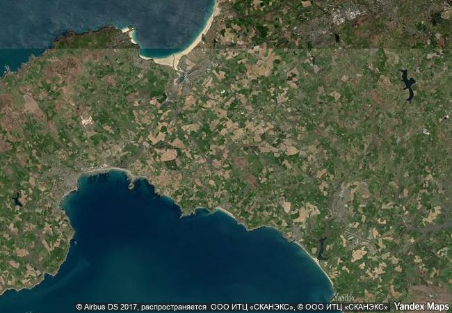
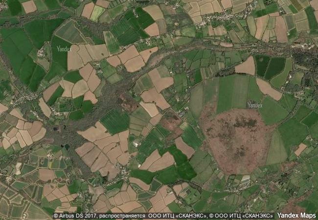
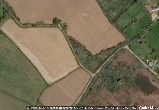
much of the landscape of cornwall and west devon was transformed in the 18th and early 19th centuries as a result of the rapid growth of pioneering copper and tin mining. its deep underground mines, engine houses, foundries, new towns, smallholdings, ports and harbours, and their ancillary industries together reflect prolific innovation which, in the early 19th century, enabled the region to produce two-thirds of the world’s supply of copper. the substantial remains are a testimony to the contribution cornwall and west devon made to the industrial revolution in the rest of britain and to the fundamental influence the area had on the mining world at large. cornish technology embodied in engines, engine houses and mining equipment was exported around the world. cornwall and west devon were the heartland from which mining technology rapidly spread.
5.7 M

United Kingdom
www.X-X-X.NAME
50,13 ° × -5,38 °

50 ° 08 ′ 10 ″ N × 5 ° 23 ′ 01 ″ W
5.921.28 km

55 ° E>NE
United Kingdom, England, Cornwall County

Atlantic Ocean / British Isles / United Kingdom / Great Britain / England / Cornwall County
Paleochristian and Byzantine Monuments of Thessalonika

Prefecture of Thessaloniki, Region of Central Macedonia

8.343.20 km
Hoi An Ancient Town

Hoi An Town, Quang Nam Province

13.695.16 km
Deer Stone Monuments and Related Bronze Age Sites

Asia and the Pacific

10.253.74 km
Archaeological Site of Nalanda Mahavihara at Nalanda, Bihar

Asia and the Pacific

12.678.04 km
Ombilin Coal Mining Heritage of Sawahlunto

Asia and the Pacific

15.640.24 km
Meidan Emam, Esfahan

Esfahan

10.691.70 km
Cultural Sites of Al Ain (Hafit, Hili, Bidaa Bint Saud and Oases Areas)

Arab States

11.714.47 km
Schwerin Residence Ensemble

Europe and North America

6.802.89 km
Lower Valley of the Omo

Southern Nation Nationalities & Peoples Region

12.057.38 km
Richtersveld Cultural and Botanical Landscape

Northern Cape

12.816.42 km
Studley Royal Park including the Ruins of Fountains Abbey

North Yorkshire, England

6.008.28 km
Wooden Hypostyle Mosques of Medieval Anatolia

Europe and North America

8.961.91 km

©

1 X ™


BRAND COM CORP GLOBAL INT

AAA BASE GRAND HIGH ORIGINAL QUALITY TOP UNIQUE

X-X-X•NAME
1 X ™ unesco
Info
Map
similar
language
guest


1 X
-4
IP : America/New_York
-4
IP : America/New_York