X 1 xXx
unesco


Lena Pillars Nature Park

Europe and North America

8.497.68 km
0

Lena Pillars Nature Park


Identifier 1299
states russian
category natural
criteria (viii)
Title lena pillars nature park
latitude 60.6666679382
longitude 127.0000000000
Region europe and north america
year 2012
unique number 2116
description 
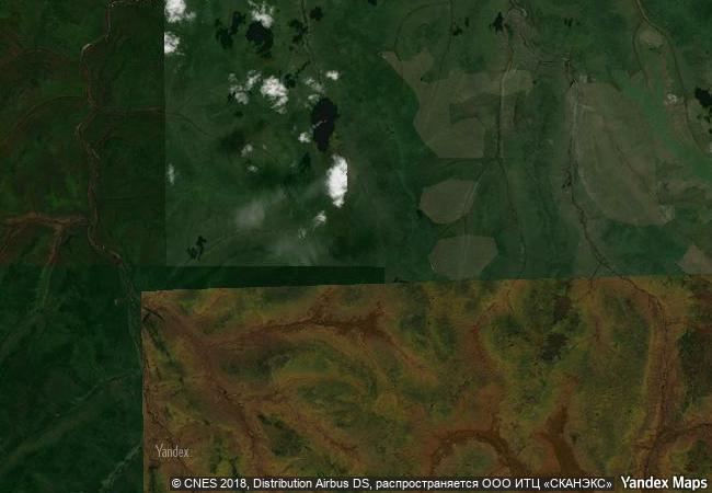
lena pillars nature park is marked by spectacular rock pillars that reach a height of approximately 100 m along the banks of the lena river in the central part of the sakha republic (yakutia). they were produced by the region’s extreme continental climate with an annual temperature range of almost 100 degrees celsius (from –60 °c in winter to +40 °c in summer). the pillars form rocky buttresses isolated from each other by deep and steep gullies developed by frost shattering directed along intervening joints. penetration of water from the surface has facilitated cryogenic processes (freeze-thaw action), which have widened gullies between pillars leading to their isolation. fluvial processes are also critical to the pillars. the site also contains a wealth of cambrian fossil remains of numerous species, some of them unique.
6.7 M
(3)

Russian Federation
www.X-X-X.NAME
60.6666679382 ° × 127 °

60 ° 40 ′ 00 ″ N × 127 ° 00 ′ 00 ″ E
8.497.68 km

299 ° NW
Russia, Republic of Sakha (Yakutia), natsionalny park Lenskiye Stolby

Russia / Far Eastern Federal District / Republic of Sakha (Yakutia) / Olyokminskiy rayon / Sanyyakhtakhskiy nasleg / natsionalny park Lenskiye Stolby
Manovo-Gounda St Floris National Park

Bamingui-Bangoran

10.576.25 km
Coiba National Park and its Special Zone of Marine Protection

Provinces of Veraguas and Chiriquí

3.619.22 km
Colchic Rainforests and Wetlands

Europe and North America

9.373.17 km
Los Alerces National Park

Latin America and the Caribbean

9.276.50 km
Mosi-oa-Tunya / Victoria Falls

Livingstone District of Southern Province of the Republic of Zambia and Hwange District of Matabeleland North Province of Zimbabwe

12.863.63 km
Sangha Trinational

Africa

10.632.42 km
Wet Tropics of Queensland

Asia and the Pacific

14.662.70 km
Uvs Nuur Basin

Uvs Aimag, Zavhan Aimag, Huvsgul Aimag (Mongolia); Mongun-Taiga Kojuun, Ovur Kojuun, Tes-Khem Kojuun, Ersin Kojuun (Tuva)

9.972.45 km
Saryarka – Steppe and Lakes of Northern Kazakhstan

Asia and the Pacific

9.604.12 km
Shiretoko

Hokkaido prefecture

9.520.82 km
Teide National Park

Canary Island, Santa Cruz de Tenerife

6.105.63 km
Gough and Inaccessible Islands

Tristan da Cunha Island group, St Helena Dependency

11.588.07 km

©

1 X ™


BRAND COM CORP GLOBAL INT

AAA BASE GRAND HIGH ORIGINAL QUALITY TOP UNIQUE

X-X-X•NAME
1 X ™ unesco
Info
Map
similar
language
guest


1 X
-4
IP : America/New_York
-4
IP : America/New_York