X 1 xXx
unesco


Shushtar Historical Hydraulic System

Asia and the Pacific

10.600.74 km
0

Shushtar Historical Hydraulic System


Identifier 1315
states ir
category cultural
criteria (i)(ii)(v)
Title shushtar historical hydraulic system
latitude 32.0186119080
longitude 48.8358345032
Region asia and the pacific
year 2009
unique number 1599
description 
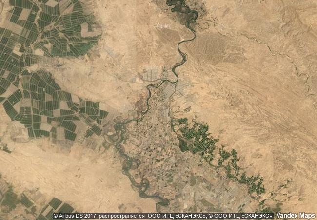
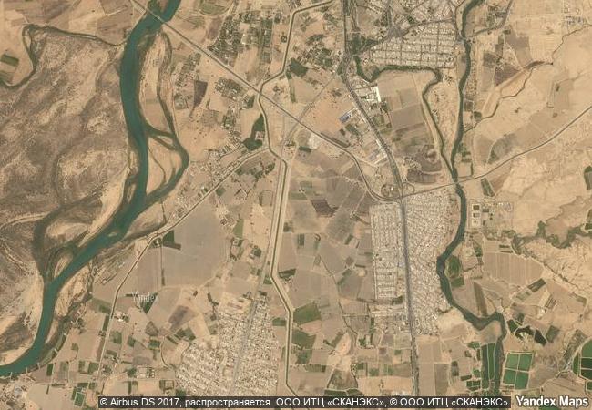
shushtar, historical hydraulic system, inscribed as a masterpiece of creative genius, can be traced back to darius the great in the 5th century b.c. it involved the creation of two main diversion canals on the river kârun one of which, gargar canal, is still in use providing water to the city of shushtar via a series of tunnels that supply water to mills. it forms a spectacular cliff from which water cascades into a downstream basin. it then enters the plain situated south of the city where it has enabled the planting of orchards and farming over an area of 40,000 ha. known as mianâb (paradise). the property has an ensemble of remarkable sites including the salâsel castel, the operation centre of the entire hydraulic system, the tower where the water level is measured, dams, bridges, basins and mills. it bears witness to the know-how of the elamites and mesopotamians as well as more recent nabatean expertise and roman building influence.
3.7 M
(1)

Iran
22.6 K

Shushtar
www.X-X-X.NAME
32.018611908 ° × 48.8358345032 °

32 ° 01 ′ 07 ″ N × 48 ° 50 ′ 09 ″ E
10.600.74 km

184 ° S>SW
Iran, Khuzestan, Shushtar

Iran / Khuzestan / Shushtar
Town Hall and Roland on the Marketplace of Bremen

Bremen (city-state)

6.679.84 km
Classical Weimar

State of Thuringia (Thüringen)

6.944.16 km
Archaeological Site of Olympia

Prefecture of Ilia, Region of West Greece in the Western Peloponnese

8.471.02 km
Garrison Border Town of Elvas and its Fortifications

Europe and North America

6.304.19 km
Amphitheatre of El Jem

El-Mahdia

7.860.86 km
Temple of Apollo Epicurius at Bassae

Prefectures of Messenia, Arcadia, and Ilia in the Western Peloponnese

8.503.45 km
Curonian Spit

Klaipeda Region, Neringa and Klaipeda (Lithuania); Kaliningrad Region, Zelenogradsk District (Russian Federation)

7.228.52 km
Bordeaux, Port of the Moon

Department of Gironde, Region of Aquitaine

6.490.32 km
Villages with Fortified Churches in Transylvania

Counties of Alba, Brasov, Harghita, Mureş, Sibiu, Region of Transylvania

8.060.33 km
Djerba: Testimony to a settlement pattern in an island territory

Arab States

7.981.44 km
Nan Madol: Ceremonial Centre of Eastern Micronesia

Asia and the Pacific

11.872.30 km
Churches of Peace in Jawor and Świdnica

Jawor and Świdnica counties, Lower Silesian (Dolnoslaskie) Voivodship

7.228.59 km

©

1 X ™


BRAND COM CORP GLOBAL INT

AAA BASE GRAND HIGH ORIGINAL QUALITY TOP UNIQUE

X-X-X•NAME
1 X ™ unesco
Info
Map
similar
language
guest


1 X
-4
IP : America/New_York
-4
IP : America/New_York