xXx 1 X
unesco


Namhansanseong

Asia and the Pacific

10.869.95 km
0

Namhansanseong


Identifier 1439
states kr
category cultural
criteria (ii)(iv)
Title namhansanseong
latitude 37.4788894653
longitude 127.1811141968
Region asia and the pacific
year 2014
unique number 1982
description 
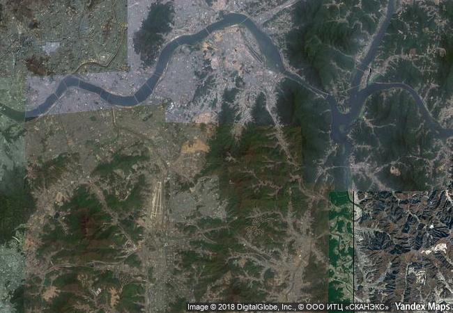
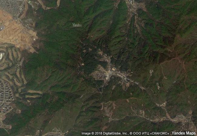
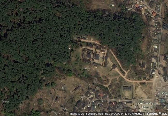
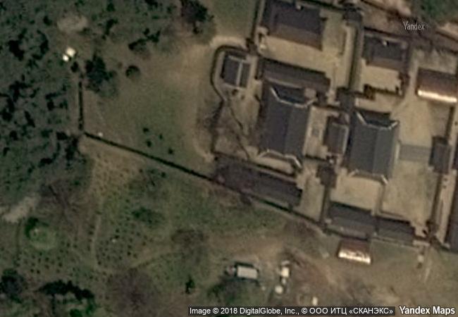
namhansanseong was designed as an emergency capital for the joseon dynasty (1392–1910), in a mountainous site 25 km south-east of seoul. built and defended by buddhist monk-soldiers, it could accommodate 4,000 people and fulfilled important administrative and military functions. its earliest remains date from the 7th century, but it was rebuilt several times, notably in the early 17th century in anticipation of an attack from the sino-manchu qing dynasty. the city embodies a synthesis of the defensive military engineering concepts of the period, based on chinese and japanese influences, and changes in the art of fortification following the introduction from the west of weapons using gunpowder. a city that has always been inhabited, and which was the provincial capital over a long period, it contains evidence of a variety of military, civil and religious buildings and has become a symbol of korean sovereignty.
5.82 M
(1)

South Korea
www.X-X-X.NAME
37,47 ° × 127,18 °

37 ° 29 ′ 44 ″ N × 127 ° 11 ′ 52 ″ E
10.869.95 km

18 ° N>NE
Republic of Korea, Gyeonggi Province

Republic of Korea / Gyeonggi Province
Stari Ras and Sopoćani

Vicinity of Novi Pazar, Raška District, Republic of Serbia

8.005.60 km
Bagan

Asia and the Pacific

13.216.28 km
Itchan Kala

Khorezm region, Khiva

10.243.03 km
Arslantepe Mound

Europe and North America

9.458.58 km
Wooden Tserkvas of the Carpathian Region in Poland and Ukraine

Europe and North America

7.606.71 km
Sítio Roberto Burle Marx

Latin America and the Caribbean

8.110.11 km
The Four Lifts on the Canal du Centre and their Environs, La Louvière and Le Roeulx (Hainaut)

Europe and North America

6.525.22 km
Roman Monuments, Cathedral of St Peter and Church of Our Lady in Trier

State of Rhineland-Palatinate (Rheinland-Pfalz)

6.720.65 km
Aapravasi Ghat

Port Louis District

15.673.09 km
Rock Shelters of Bhimbetka

Madhya Pradesh

12.737.97 km
The Causses and the Cévennes, Mediterranean agro-pastoral Cultural Landscape

Europe and North America

6.805.69 km
Talayotic Menorca

Europe and North America

7.073.44 km

©

1 X ™


BRAND COM CORP GLOBAL INT

AAA BASE GRAND HIGH ORIGINAL QUALITY TOP UNIQUE

X-X-X•NAME
1 X ™ unesco
Info
Map
similar
language
guest


1 X
-4
IP : America/New_York
-4
IP : America/New_York