X 1 xXx
unesco


Ancient Jericho/Tell es-Sultan

Arab States

9.822.46 km
0

Ancient Jericho/Tell es-Sultan


Identifier 1687
states ps
category cultural
criteria (iii)(iv)
Title ancient jericho/tell es-sultan
latitude 31.8713054657
longitude 35.4440574646
Region arab states
year 2023
unique number 2475
description 
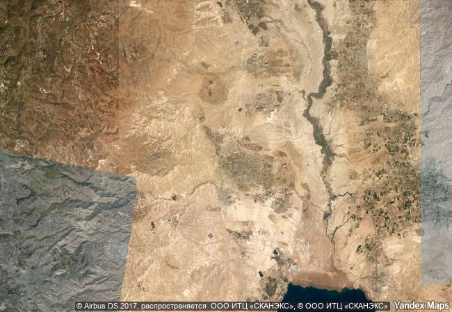
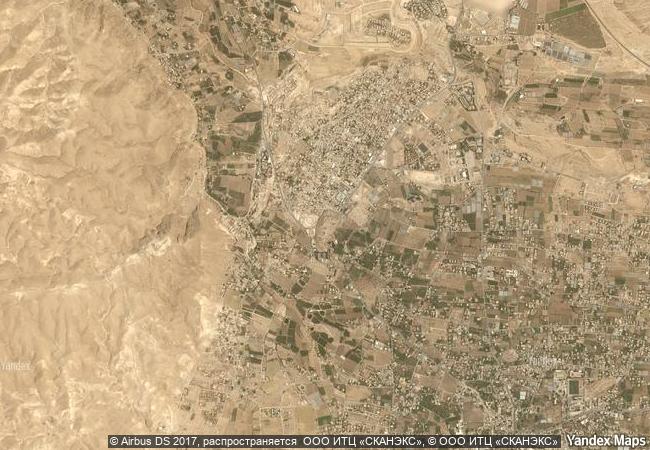
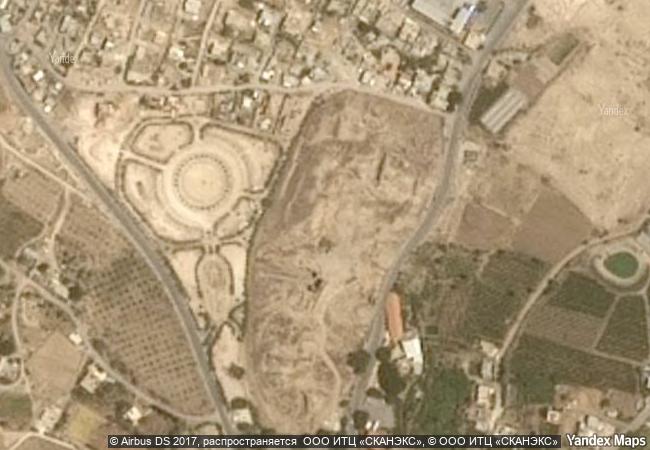
ancient jerico/tell es-sultan is located northwest of present-day jericho in the jordan valley in palestine, the property is an oval-shaped tell, or mound, that contains the prehistorical deposits of human activity, and includes the adjacent perennial spring of ‘ain es-sultan. by the 9th to 8th millennium bc, neolithic ancient jericho/tell es-sultan was already a sizeable permanent settlement, as expressed by surviving monumental architectural attributes such as a wall with a ditch and a tower. it reflects the developments of the period, which include the shifting of humanity to a sedentary communal lifestyle and the related transition to new subsistence economies, as well as changes in social organisation and the development of religious practices, testified by skulls and statues found. the early bronze age archaeological material on the site provides insights into urban planning, while vestiges from the middle bronze age reveal the presence of a large canaanite city-state, equipped with an urban centre and technologically innovative rampart fortifications, occupied by a socially complex population.
4.13 M

Palestine
420.3 K

Jericho
www.X-X-X.NAME
31.8713054657 ° × 35.4440574646 °

31 ° 52 ′ 17 ″ N × 35 ° 27 ′ 39 ″ E
9.822.46 km

226 ° W>SW
Palestine, Jericho

Palestine / West Bank / Jericho
Antigua Guatemala

Department of Sacatepéquez, Panchoy Valley

2.923.46 km
Human Rights, Liberation and Reconciliation: Nelson Mandela Legacy Sites

Africa

13.557.47 km
Pre-Hispanic Town of Uxmal

Etat de Yucatan, municipalites Muna et Santa Elena

2.272.59 km
Chankillo Archaeoastronomical Complex

Latin America and the Caribbean

5.528.19 km
Namhansanseong

Asia and the Pacific

10.869.95 km
Historic Centre of the Town of Diamantina

State of Minas Gerais

7.652.11 km
La Grand-Place, Brussels

City of Brussels, Brussels-Capital Region

6.520.79 km
Studenica Monastery

Village of Studenica, Commune of Kraljevo, Raška District, Republic of Serbia

7.987.14 km
Archaeological Landscape of the First Coffee Plantations in the South-East of Cuba

Santiago and Guantanamo Provinces, South-Eastern Region

2.332.17 km
Ajanta Caves

Maharashtra State, Aurangabad District , Soyagon Taluka, Lenapur Village

12.932.82 km
Petroglyphic Complexes of the Mongolian Altai

Asia and the Pacific

10.050.01 km
Historic City of Toledo

Province of Toledo, Autonomous Community of Castile-La Mancha

6.493.11 km

©

1 X ™


BRAND COM CORP GLOBAL INT

AAA BASE GRAND HIGH ORIGINAL QUALITY TOP UNIQUE

X-X-X•NAME
1 X ™ unesco
Info
Map
similar
language
guest


1 X
-4
IP : America/New_York
-4
IP : America/New_York