Historic Monuments Zone of Tlacotalpan
State of Veracruz, Tlacotalpan Municipality
|

|
Identifier |
862 |
|

|
states |
mx |
|

|
category |
cultural |
|

|
criteria |
(ii)(iv) |
|

|
Title |
historic monuments zone of tlacotalpan |
|

|
latitude |
18.6134586334 |
|

|
longitude |
-95.6586761475 |
|

|
location |
state of veracruz, tlacotalpan municipality |
|

|
Region |
latin america and the caribbean |
|

|
year |
1998 |
|

|
unique number |
1013 |
|

|
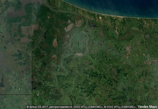
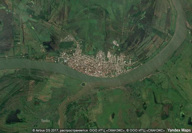
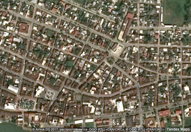
description |
tlacotalpan, a spanish colonial river port on the gulf coast of mexico, was founded in the mid-16th century. it has preserved its original urban fabric to a remarkable degree, with wide streets, colonnaded houses in a profusion of styles and colours, and many mature trees in the public open spaces and private gardens. |
|

|
justification |
criterion ii: the urban layout and architecture of tlacotalpan represent a fusion of spanish and caribbean traditions of exceptional importance and quality. criterion iv: tlacotalpan is a spanish colonial river port on the gulf coast of mexico which has preserved its original urban fabric to an exceptional degree. its outstanding character lies in its townscape of wide streets, modest houses in an exuberant variety of styles and colours, and many mature trees in public and private open spaces. |
|


 0
0


 1 X ™ unesco
 Info
Info
 Map
Map
 similar
 language