1 xXx X
2
unesco


Saint Hilarion Monastery/ Tell Umm Amer

Arab States

9.788.01 km
0

Saint Hilarion Monastery/ Tell Umm Amer


Identifier 1749
states ps
category cultural
criteria (ii)(iii)(vi)
Title saint hilarion monastery/ tell umm amer
latitude 31.4473056793
longitude 34.3663597107
Region arab states
year 2024
unique number 2628
description 
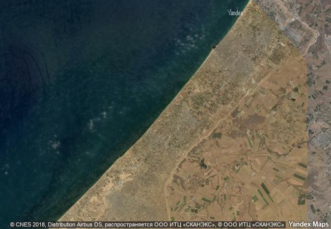
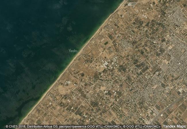
situated on the coastal dunes in nuseirat municipality, the ruins of saint hilarion monastery/ tell umm amer represent one of the earliest monastic sites in the middle east, dating back to the 4th century. founded by saint hilarion, the monastery began with solitary hermits and evolved into a coenobitic community. it was the first monastic community in the holy land, laying the groundwork for the spread of monastic practices in the region. the monastery occupied a strategic position at the crossroads of major trade and communication routes between asia and africa. this prime location facilitated its role as a hub of religious, cultural, and economic interchange, exemplifying the flourishing of monastic desert centres during the byzantine period.
8.96 M

Palestine
www.X-X-X.NAME
31,44 ° × 34,36 °

31 ° 27 ′ 50 ″ N × 34 ° 22 ′ 59 ″ E
9.788.01 km

288 ° W>NW
Palestine, Gaza Strip, Muhafaza Deir al Balah

Palestine / Gaza Strip / Muhafaza Deir al Balah
Archaeological Ensemble of Tarraco

Province of Tarragona, Autonomous Community of Catalonia,

6.817.53 km
Ancient Jericho/Tell es-Sultan

Arab States

9.822.46 km
Alhambra, Generalife and Albayzín, Granada

Province of Granada, Autonomous Community of Andalusia

6.669.57 km
Arab-Norman Palermo and the Cathedral Churches of Cefalú and Monreale

Europe and North America

7.867.56 km
Wieliczka and Bochnia Royal Salt Mines

Europe and North America

7.521.34 km
Ellora Caves

Maharashtra State, Aurangabad District, Khulatabad Taluk , Verul Village

12.971.32 km
Ancient Ksour of Ouadane, Chinguetti, Tichitt and Oualata

Oudane, Chinguetti: region de l’Adrar; Tichitt: region du Tagant; Oualata: region du Hodh Echchargut

6.976.72 km
Mahabodhi Temple Complex at Bodh Gaya

State of Bihar, Eastern India

12.718.61 km
Cultural Landscape of Khinalig People and “Köç Yolu” Transhumance Route

Europe and North America

9.810.54 km
Island of Mozambique

Ilha de Mocambique District, Nampula Province

13.932.03 km
Tyre

City and District of Tyre, Governorate of South Lebanon

9.692.10 km
Royal Tombs of the Joseon Dynasty

Asia and the Pacific

10.854.15 km

©

1 X ™


BRAND COM CORP GLOBAL INT

AAA BASE GRAND HIGH ORIGINAL QUALITY TOP UNIQUE

X-X-X•NAME
1 X ™ unesco
Info
Map
similar
language
guest


1 X
-4
IP : America/New_York
-4
IP : America/New_York