1 X xXx ™
5
⬤
unesco
⬤


☆
Historic Monuments of Ancient Kyoto (Kyoto, Uji and Otsu Cities)

Kyoto and Shiga prefectures

10.783.39 km
☆
★★★★☆
0

Historic Monuments of Ancient Kyoto (Kyoto, Uji and Otsu Cities)


Kyoto and Shiga prefectures
Identifier 688
states jp
category cultural
criteria (ii)(iv)
Title historic monuments of ancient kyoto (kyoto, uji and otsu cities)
latitude 34.9805564880
longitude 135.7694396973
location kyoto and shiga prefectures
Region asia and the pacific
year 1994
unique number 814
description built in a.d. 794 on the model of the capitals of ancient china, kyoto was the imperial capital of japan from its foundation until the middle of the 19th century. as the centre of japanese culture for more than 1,000 years, kyoto illustrates the development of japanese wooden architecture, particularly religious architecture, and the art of japanese gardens, which has influenced landscape gardening the world over.
★
9.5 M
(1)

Japan
☆
66.5 K

Kyoto
www.X-X-X.NAME
34,98 ° × 135,76 °

34 ° 59 ′ 50 ″ N × 135 ° 46 ′ 10 ″ E
10.783.39 km

56 ° E>NE
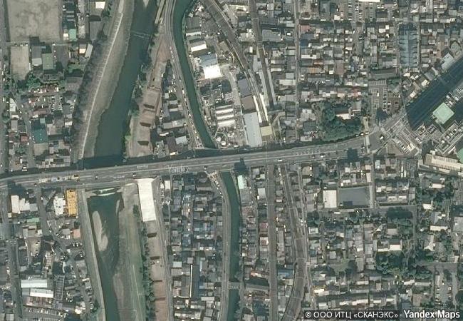
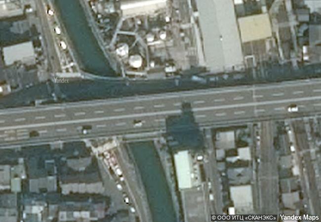
Japan, Kyoto Prefecture, Kyoto, Kudzyo Dori

Japan / Japanese archipelago / Honshu Island / Kansai Region / Kyoto Prefecture / Kyoto / Higashiyama Ward / 九条跨線橋 / Kudzyo Dori
☆
Antigua Naval Dockyard and Related Archaeological Sites

Latin America and the Caribbean

3.271.17 km
☆
Su Nuraxi di Barumini

Province of Medio Campidano, Sardinia

7.456.42 km
☆
Baroque Churches of the Philippines

Asia and the Pacific

13.462.06 km
☆
Genoa: Le Strade Nuove and the system of the Palazzi dei Rolli

Liguria Region, Genoa Province

7.168.56 km
☆
Yin Xu

Henan Province

11.371.30 km
☆
Jelling Mounds, Runic Stones and Church

Vejle Commune, Region of Southern Denmark

6.577.84 km
☆
Ancient Ferrous Metallurgy Sites of Burkina Faso

Africa

8.238.52 km
☆
Droogmakerij de Beemster (Beemster Polder)

Province of Noord-Holland

6.472.31 km
☆
La Fortaleza and San Juan National Historic Site in Puerto Rico

San Juan, Puerto Rico

2.885.63 km
☆
Routes of Santiago de Compostela in France

Regions of Aquitaine, Auvergne, Basse-Normandie, Bourgogne, Centre, Champagne-Ardenne, Ile-de-France, Languedoc-Roussillon, Limousin, Midi-Pyrénées, Picardie, Poitou-Charentes, and Provence-Alpes-Côte d’Azur

6.563.25 km
☆
Frontiers of the Roman Empire – The Lower German Limes

Europe and North America

6.460.77 km
☆
18th-Century Royal Palace at Caserta with the Park, the Aqueduct of Vanvitelli, and the San Leucio Complex

Provinces of Caserta and Benevento, Campania

7.741.08 km

©

1 X ™


BRAND • COM • CORP • GLOBAL • INT

AAA • BASE • GRAND • HIGH • ORIGINAL • QUALITY • TOP • UNIQUE

™X-X-X•NAME
1 X ™ unesco
Info
Map
similar
language
▼ ▼ ▼
guest


1 X
™
-4
IP : America/New_York
-4
IP : America/New_York
▼ ▼ ▼
►
►